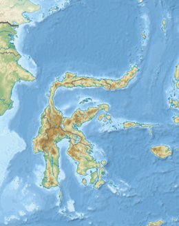
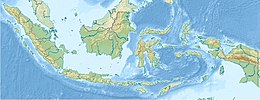
On 18 August 2012, at 17:41:52 WITA (09:41:52 UTC), a Mw 6.3 earthquake struck Sigi Regency in Central Sulawesi, Indonesia, 51 km (32 mi) south-southeast of Palu.[1]
| UTC time | 2012-08-18 09:41:52 |
|---|---|
| USGS-ANSS | ComCat |
| Local date | 18 August 2012 |
| Local time | 17:41:52 WITA (UTC+8) |
| Magnitude | 6.3 Mw |
| Depth | 10 km (6 mi) |
| Epicenter | 1°18′54″S 120°05′46″E / 1.315°S 120.096°E |
| Areas affected | Sulawesi, Indonesia |
| Max. intensity | MMI VIII (Severe) |
| Landslides | Yes |
| Casualties | 6 fatalities, 43 injuries |
Tectonic setting
editThis section is empty. You can help by adding to it. (November 2024) |
Earthquake
editThe United States Geological Survey reported a magnitude (Mww ) of 6.3, at a depth of 10 km (6.2 mi) and a maximum Modified Mercalli intensity of VIII (Severe).[1]
Impact
editSix people were killed by falling debris and tons of mud, including a nine-year-old boy. 43 others were injured, including 8 in critical condition. 471 homes were destroyed and 1,097 damaged in the epicentral area. Landslides also blocked roads and some bridges.[2][3]
References
edit- ^ a b ANSS. "M 6.3 - 51 km SSE of Palu, Indonesia 2012". Comprehensive Catalog. U.S. Geological Survey.
- ^ National Geophysical Data Center / World Data Service (NGDC/WDS): NCEI/WDS Global Significant Earthquake Database. NOAA National Centers for Environmental Information. "Significant Earthquake Information". Retrieved 22 November 2024.
- ^ "Earthquake rocks central Indonesia province". Al Jazeera English. 18 August 2024. Retrieved 22 November 2024.


