The Debenham Islands (68°08′S 67°07′W / 68.133°S 67.117°W) are a group of islands and rocks lying between Millerand Island and the west coast of Graham Land, Antarctica.[1]
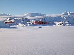
 San Martín Base on Barry Island | |
| Geography | |
|---|---|
| Location | Marguerite Bay, Antarctica |
| Coordinates | 68°08′S 67°07′W / 68.133°S 67.117°W |
| Archipelago | Debenham Islands |
| Total islands | 6 |
Location
editThe Debenham Islands are in Marguerite Bay in Graham Land on the Fallières Coast of the Antarctic Peninsula. They are south of Cape Calmette, north of Millerand Island and west of the mouth of Northeast Glacier.[2] The Argentinian San Martín Base is located on Barry Island.[3]
Discovery and name
editThe Debenham Islands were discovered and named by the British Graham Land Expedition (BGLE) (1934–37) under John Rymill. The BGLE base was on Barry Island, in the center of the group, during part of this time. They were named for Frank Debenham, who served as a member of the BGLE Advisory Committee.[1]
Powell Channel
edit68°08′S 67°07′W / 68.133°S 67.117°W. A narrow channel between Millerand Island and the Debenham Islands. Named by the UK Antarctic Place-Names Committee (UK-APC) for Lieutenant John M. Powell, RN, who surveyed the channel in 1972.[1]
Islands
editBarbara Island
edit68°08′S 67°06′W / 68.133°S 67.100°W. The largest and northernmost of the Debenham Islands. Discovered by the BGLE, 1934-37, under Rymill, and named by him for a daughter of Frank Debenham.[4]
Ann Island
edit68°08′S 67°06′W / 68.133°S 67.100°W. An island lying southeast of Barbara Island, off the west coast of Graham Land. Discovered by the BGLE, 1934-37, under Rymill, and named by him for a daughter of Frank Debenham.[5]
Barry Island
edit68°08′S 67°07′W / 68.133°S 67.117°W. An island lying in the center of the Debenham Islands, off the west coast of Graham Land. Charted by the BGLE under Rymill, who used this island for a base in 1936 and 1937. Named by Rymill for the eldest son of Frank Debenham.[6]
Brian Island
edit68°08′S 67°07′W / 68.133°S 67.117°W. The westernmost of the Debenham Islands. Charted by the BGLE, 1934-37, under Rymill, who named it for a son of Frank Debenham.[7]
Audrey Island
edit68°08′S 67°07′W / 68.133°S 67.117°W. The southernmost island in the Debenham Islands, off the west coast of Graham Land. Discovered by the BGLE, 1934-37, under Rymill, and named by him for a daughter of Frank Debenham.[8]
June Island
edit68°08′S 67°07′W / 68.133°S 67.117°W. An island in the Debenham Islands lying close southwest of Audrey Island. Discovered and charted by the BGLE, 1934-37, under Rymill, who named it for a daughter of Frank Debenham.[9]
References
edit- ^ a b c Alberts 1995, p. 178.
- ^ Palmer Land USGS.
- ^ Base San Martín Marambio.
- ^ Alberts 1995, p. 44.
- ^ Alberts 1995, p. 22.
- ^ Alberts 1995, p. 48.
- ^ Alberts 1995, p. 93.
- ^ Alberts 1995, p. 33.
- ^ Alberts 1995, p. 379.
Sources
edit- Alberts, Fred G., ed. (1995), Geographic Names of the Antarctic (PDF) (2 ed.), United States Board on Geographic Names, retrieved 3 December 2023 This article incorporates public domain material from websites or documents of the United States Board on Geographic Names.
- "Base San Martín" (in Spanish). Fundaciòn Marambio. Archived from the original on 28 December 2013.
- Palmer Land, USGS: United States Geological Survey, retrieved 25 April 2024
This article incorporates public domain material from websites or documents of the United States Geological Survey.
