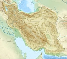
Lake Bakhtegan (Persian: دریاچۀ بختگان) was a salt lake in Fars Province, southern Iran, about 160 km (99 mi) east of Shiraz and 15 km (9.3 mi) west of the town of Neyriz.
| Lake Bakhtegan | |
|---|---|
 Former Lake Bakhtegan in the year 2013 | |
| Coordinates | 29°21′55″N 53°50′19″E / 29.3654°N 53.8385°E |
| Type | Salt lake |
| Primary inflows | Kor River |
| Basin countries | Iran |
| Surface area | 3,500 km2 (1,400 sq mi) |
| Islands | Menak Island |
With a surface area of 3,500 square kilometres (1,400 sq mi), Bakhtegan was Iran's second-largest lake. It was fed by the Kor River.[1] The construction of several dams on the Kor River had significantly reduced the water flow into the lake, increased its salinity, and extirpated the lake's populations of flamingos and other migratory birds.[1] Lake Bakhtegan is now completely dry and the living species have either died or moved to other locations.
Description
editLake Bakhtegan, once Iran's second largest lake, was fed mostly by the Kur River,[2] while Lake Tashk was fed by overflow from the marshes at its west end and by a large permanent spring in the northwest.
Despite being naturally segregated by narrow strips of land, they used to join to form a single lake during years of heavy rainfall.[3] The lakes became completely dry from 2008 through 2010 and the ecosystem has suffered adverse effects.[4]
As of 1992, the lakes supported more than 120,000 ducks and had a population of 50,000 Phoenicopterus ruber.[5]
The two lakes, their delta and spring-fed marshes covering 108,000 hectares (270,000 acres) were designated as Wetlands of International Importance by the Ramsar Convention on Wetlands in 1975.[6]
References
edit- ^ a b "Bakhtegan Ecology Alarming", Iran Daily, Aug. 9, 2007
- ^ "Bakhtegan wetland shrinking, flamingo chicks in danger". Tehran Times. 8 July 2019.
- ^ "Lake Bakhtegan, Lake Tashk and Kamjan marshes". Key Biodiversity Areas. Retrieved 16 March 2024.
- ^ Amirkhani, Masoud; Zarei, Heidar; Radmanesh, Fereydoun; Pande, Saket (2022). "An operational sociohydrological model to understand the feedbacks between community sensitivity and environmental flows for an endorheic lake basin, lake Bakhtegan, Iran". Journal of Hydrology. 605: 127375. Bibcode:2022JHyd..60527375A. doi:10.1016/j.jhydrol.2021.127375.
- ^ "Lake Bakhtegan, Lake Tashk and Kamjan marshes". Data Zone. BirdLife International. Retrieved 16 March 2024.
- ^ Integrated Management Plan of Bakhtegan Lake (PDF). Conservation of Iranian Wetlands Project.
