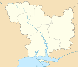
Blahodatne (Ukrainian: Благодатне) is a village in the Mykolaiv Raion of the Mykolaiv Oblast. It belongs to Pervomaiske settlement hromada, one of the hromadas of Ukraine.[1] There are 474 inhabitants as of 2001.
Blahodatne
Благодатне | |
|---|---|
Village | |
| Coordinates: 47°1′57″N 32°32′50″E / 47.03250°N 32.54722°E | |
| Country | |
| Oblast | Mykolaiv Oblast |
| Raion | Mykolaiv Raion |
| Established | 1939 |
| Area | |
• Total | 1.64 km2 (0.63 sq mi) |
| Elevation | 55 m (180 ft) |
| Population | |
• Total | 474 |
History
editThe village was founded in 1939 under the original name Komsomolske.
On May 12, 2016, the village of Komsomolske was renamed Blahodatne.[2]
Until 18 July 2020, Blahodatne belonged to Vitovka Raion. The raion was abolished in July 2020 as part of the administrative reform of Ukraine, which reduced the number of raions of Mykolaiv Oblast to four. The area of Vitovka Raion was merged into Mykolaiv Raion.[3][4]
During the 2022 Russian Invasion of Ukraine, the village came under attack and was occupied by Russian forces on 22 August 2022.[5][6]
References
edit- ^ "Первомайская громада" (in Russian). Портал об'єднаних громад України.
- ^ "Про перейменування деяких населених пунктів". Офіційний вебпортал парламенту України (in Ukrainian). Retrieved 2022-08-23.
- ^ "Про утворення та ліквідацію районів. Постанова Верховної Ради України № 807-ІХ". Голос України (in Ukrainian). 2020-07-18. Retrieved 2020-10-03.
- ^ "Нові райони: карти + склад" (in Ukrainian). Міністерство розвитку громад та територій України.
- ^ "At Mykolaiv direction Russian forces conducting assault actions at Vasylki-Blahodatne direction, have partial success, seized southern part of Blahodatne village, - General Staff of Armed Forces of Ukraine says in the morning report Kherson - Ukraine Interactive map - Ukraine Latest news on live map - liveuamap.com". Ukraine Interactive map - Ukraine Latest news on live map - liveuamap.com. Retrieved 2022-08-23.
- ^ "Institute for the Study of War".

