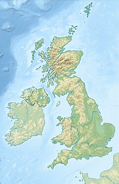
The Chilbolton Observatory is a facility for atmospheric and radio research located on the edge of the village of Chilbolton near Stockbridge in Hampshire, England. The facilities are run by the STFC Radio Communications Research Unit of the Rutherford Appleton Laboratory and form part of the Science and Technology Facilities Council.
 The 25 metre (82') steerable antenna installation at the Chilbolton Observatory. | |
| Organization | |
|---|---|
| Location | Chilbolton, Test Valley, Hampshire, South East England, England |
| Coordinates | 51°08′40″N 1°26′19″W / 51.14456°N 1.43858°W |
| Website | www |
| Telescopes | |
| | |
Overview
editThe Chilbolton Observatory operates many pieces of research equipment associated with radar propagation and meteorology. As of 2007[update], these include:[1]
- An S band Doppler weather radar with its distinctive, fully steerable, 25 metre (82') parabolic antenna. This equipment can be referred to as CAMRa (Chilbolton Advanced Meteorological Radar).
- An L band Clear-air radar
- A W band bistatic zenith radar
- A UV Raman Lidar
- Multiple Ka band radiometers
- Multiple rain gauges
The observatory also hosts the UK's LOFAR station.
Timeline of projects
edit- 1998 - CLARE'98 Cloud Lidar and Radar experiment,[2] which eventually fed into the European Space Agency EarthCARE programme[3]
- 2001 to 2004 - CLOUDMAP2[4] project to assist in Numerical weather prediction models
- 2006 - Chilbolton Observatory joined forces with several European Space Agency sites to verify the L band radio transmissions from the GIOVE-A satellite[5]
- 2006 - NERC Cirrus and Anvils: European Satellite and Airborne Radiation measurements project
- 2008 - In-Orbit Test (IOT) performed for GIOVE-B
- 2008-9 - APPRAISE,[6] during which the CAMRa and Lidar were used to direct airborne measurements in mixed-phase clouds
- 2010 - LOFAR station UK608 constructed
History
editConstruction of Chilbolton Observatory started in 1963. It was built partially on the site of RAF Chilbolton, which was decommissioned in 1946. Several sites around the south-east of England were considered for the construction. The site at Chilbolton, on the edge of Salisbury Plain, was chosen in part because of excellent visibility of the horizon and its relative remoteness from major roads whose cars could cause interference.
The facility was opened in April 1967. Within several months of being commissioned the azimuth bearing of the antenna suffered a catastrophic failure. GEC were contracted to repair the bearing and devised a system to replace the failed part while leaving the 400 tonne dish ostensibly in-place.
Originally, the antenna was engaged in Ku band radio astronomy, but now operates as a S and L band radar.
References
edit- ^ "Chilbolton Facilities". Chilbolton.rl.ac.uk. 10 March 2011. Retrieved 23 February 2021.
- ^ "Chilbolton Observatory". Archived from the original on 9 October 2006. Retrieved 23 February 2021.
- ^ "ESA - Living Planet Programme - EarthCARE". Archived from the original on 12 January 2007. Retrieved 7 January 2007.
- ^ "CLOUDMAP2 at CCLRC". Archived from the original on 10 May 2006. Retrieved 23 February 2021.
- ^ "ESA - GIOVE A transmits loud and clear". Esa.int. 28 December 2005. Retrieved 23 February 2021.
- ^ "appraise - Home". Archived from the original on 25 June 2009. Retrieved 23 February 2021.
External links
edit- Chilbolton Observatory Facilities retrieved May 17, 2006
- CLOUDMAP2 project homepage
- ESA News 'GIOVE A transmits loud and clear', ESA Portal - Improving Daily Life, March 9, 2006, retrieved May 17, 2006
