Churchlands is a suburb of Perth, Western Australia approximately 8 km north-west of the central business district; it lies within the local government area of the City of Stirling. Churchlands is an expensive suburb with most homes built after the 1980s. Its post code is 6018.
| Churchlands Perth, Western Australia | |||||||||||||||
|---|---|---|---|---|---|---|---|---|---|---|---|---|---|---|---|
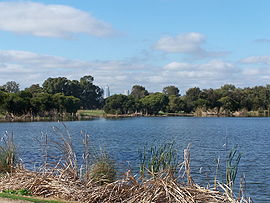
 Herdsman Lake looking SE towards Perth city centre | |||||||||||||||
 | |||||||||||||||
| Coordinates | 31°55′19″S 115°47′24″E / 31.922°S 115.79°E | ||||||||||||||
| Population | 3,638 (SAL 2021)[1] | ||||||||||||||
| Postcode(s) | 6018 | ||||||||||||||
| Location | 5 km (3 mi) NW of Perth CBD | ||||||||||||||
| LGA(s) | City of Stirling | ||||||||||||||
| State electorate(s) | Churchlands | ||||||||||||||
| Federal division(s) | Curtin | ||||||||||||||
| |||||||||||||||
History
editThis suburb became known as "Churchlands" after being purchased by the Roman Catholic Church in 1891 from the Trigg family.
Education and sporting facilities
editSchools in the area include Churchlands Primary School, Churchlands Senior High School, Hale School and Newman College.
Newman College has its years 3 to 6 and years 7 to 12 located on two campuses in Churchlands.
Subiaco Marist Cricket Club is headquartered at Newman College.
Edith Cowan
editIt was formerly home to the Churchlands campus of Edith Cowan University, which closed in 2008.
The campus had been the Churchlands Teachers College (1972-1981) and the Churchlands campus of the Western Australian College of Advanced Education (1982-1990) prior to the founding of Edith Cowan University in 1991, and was the location of the university's headquarters until 2003.[2][3]
The site was subsequently redeveloped as the Churchlands Green housing estate, while a small section of the site, including the campus amphitheatre, was set aside as Edith Cowan Reserve, serving as a memorial to the former campus.[4]
Geography
editOn the eastern border of Churchlands is the large 300-hectare (741-acre) Herdsman Lake, which is populated by many bird, amphibian and freshwater fish species. Picnic and bird-watching areas are accessible from the suburb.
Transport
editBus
edit- 83 Perth Busport to City Beach – serves Cromarty Road and Empire Avenue[5]
- 84 Perth Busport to City Beach – serves Selby Street, Flynn Street, Pearson Street and Hale Road[6]
- 85 Perth Busport to Glendalough Station – serves Selby Street[7]
- 998 Fremantle Station to Fremantle Station (limited stops) – CircleRoute Clockwise, serves Flynn Street and Pearson Street[8]
- 999 Fremantle Station to Fremantle Station (limited stops) – CircleRoute Anti-Clockwise, serves Pearson Street, Flynn Street and Selby Street[9]
See also
editReferences
edit- ^ Australian Bureau of Statistics (28 June 2022). "Churchlands (suburb and locality)". Australian Census 2021 QuickStats. Retrieved 28 June 2022.
- ^ "History of ECU and its predecessor Institutions". Edith Cowan University. Archived from the original on 30 October 2016. Retrieved 30 October 2016.
- ^ "A Young University With a Proud History". Edith Cowan University. Archived from the original on 30 October 2016. Retrieved 30 October 2016.
- ^ "Edith Cowan Reserve opens at Churchlands Green". Edith Cowan University. Archived from the original on 30 October 2016. Retrieved 30 October 2016.
- ^ "Route 83". Bus Timetable 43 (PDF). Transperth. 14 May 2024 [effective from 15 July 2024].
- ^ "Route 84". Bus Timetable 43 (PDF). Transperth. 14 May 2024 [effective from 15 July 2024].
- ^ "Route 85". Bus Timetable 43 (PDF). Transperth. 14 May 2024 [effective from 15 July 2024].
- ^ "Route 998". CircleRoute Timetable 200 (PDF) (CircleRoute). Transperth. 12 June 2024 [effective from 15 July 2024].
- ^ "Route 999". CircleRoute Timetable 200 (PDF) (CircleRoute). Transperth. 12 June 2024 [effective from 15 July 2024].