Cook's Harbour is a town in the Canadian province of Newfoundland and Labrador. The town had a population of 123 in the Canada 2016 Census.[2] The population as of 2021 was 118 (including Wild Bight and Boat Harbour) but the population has been decreasing ever since then. Cook’s Harbour is about 45 minutes away from St. Anthony NL and 6 hours from Corner Brook NL.
Cook's Harbour | |
|---|---|
Town | |
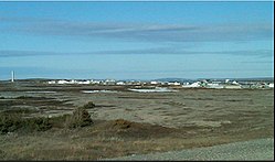
 View of Cook's Harbour | |
Location within Newfoundland Location within Canada | |
| Coordinates: 51°36′12″N 55°52′16″W / 51.60333°N 55.87111°W | |
| Country | |
| Province | |
| Area | |
| • Land | 1.95 km2 (0.75 sq mi) |
| Population (2021)[1] | |
• Total | 118 |
| • Density | 62.9/km2 (163/sq mi) |
| Time zone | UTC-3:30 (Newfoundland Time) |
| • Summer (DST) | UTC-2:30 (Newfoundland Daylight) |
| Area code | 709 |
| Highways | |
The school in Cook's Harbour is called James Cook Memorial there are 2 students in the school as of 2024.
History
editCook's Harbour was named by Captain James Cook in 1764, during his survey of Newfoundland.[3]
Demographics
editIn the 2021 Census of Population conducted by Statistics Canada, Cook's Harbour had a population of 118 living in 67 of its 92 total private dwellings, a change of -4.1% from its 2016 population of 123. With a land area of 1.94 km2 (0.75 sq mi), it had a population density of 60.8/km2 (157.5/sq mi) in 2021.[1]
References
edit- ^ a b "Population and dwelling counts: Canada, provinces and territories, census divisions and census subdivisions (municipalities), Newfoundland and Labrador". Statistics Canada. February 9, 2022. Retrieved March 15, 2022.
- ^ "Census Profile, 2016 Census". Statistics Canada. February 14, 2017. Retrieved February 15, 2017.
- ^ "Cook's Harbour". Land of First Contact. 2014. Archived from the original on 2014-10-15. Retrieved 2014-10-10.

