This article needs additional citations for verification. (June 2023) |
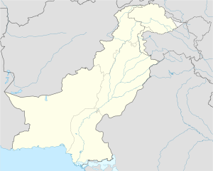
Digri (Sindhi: ڊگھڙي, Urdu: ڈگری) is a Tehsil in Mirpur Khas District Sindh, Pakistan. It is the second largest town of Mirpurkhas District.
Digri Tehsil | |
|---|---|
| Coordinates: 25°09′24″N 69°06′44″E / 25.15667°N 69.11222°E | |
| Country | Pakistan |
| Region | Mirpurkhas |
| Government | |
| • Type | Taluka Municipality |
| Area | |
| • Urban | 4 km2 (2 sq mi) |
| Population | |
| • Urban | 50,000 approximately |
| Time zone | PST |
| Area code | 92(0233) |
Geography
editDigri is connected to several towns by main roads:
- Tando Ghulam Ali Road (District Badin)
- Tando Bhago Road (District Badin)
- Mipurkhas Road
- KGM Road - Linking to District Umarkot
- TJM Road - Linking to Tharparkar
Communities
editDigri is a culturally diverse town. As the small town has grown rapidly in the last few decades, the diversity has also increased with Arain Community , Talpur Community , Malhi Community, Lohana Community, Maheshwari Community, Kolhi Community, Bheel Community, Muslim Rajputs, Kaim Khani Community, Jarwar, Baloch, Jatt and Pashtuns living there. 65% of the population of Digri are Sindhi people. The most common languages in the town are Sindhi and Urdu and also tribal languages like Dhatki as well.[1]
There are many communities have been living since the partition of Hindustan.[2]
Economy
editLivestock and poultry rearing, agricultural farms, and transportation are the main sources of income, while more than 20% population rely on government and private jobs. A sugar mill, Digri Sugar Mills, provides further job opportunities for local people.[citation needed]
References
edit- ^ Cole, J. (2006), "Sindhi", Encyclopedia of Language & Linguistics, Elsevier, pp. 384–387, doi:10.1016/b0-08-044854-2/02241-0, ISBN 978-0-08-044854-1, retrieved 2023-06-21
- ^ Kumarasingham, Harshan (July 2013). "Partition of India: Why 1947?". Asian Affairs. 44 (2): 302–303. doi:10.1080/03068374.2013.795297. ISSN 0306-8374. S2CID 162312225.
External links
edit- Find Distance
- Population of Dhigri
- Complete map of the city
- https://www.facebook.com/pages/Digri-city/367347073786
