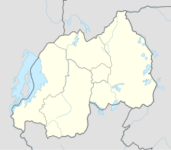
Rwezamenyo is a sector (umurenge) in the Kigali Province, Nyarugenge district, Rwanda. It is located in the southwest part of the city of Kigali.
Rwezamenyo | |
|---|---|
| Coordinates: 1°58′7″S 30°3′20″E / 1.96861°S 30.05556°E | |
| Country | |
| Province | Kigali Province |
| District | Nyarugenge |
| Area | |
| • Total | 2.66 km2 (1.027 sq mi) |
| • Land | 1.027 km2 (0.397 sq mi) |
| Population (2022 census) | |
| • Total | 14,754 |
| • Density | 5,500/km2 (14,000/sq mi) |
| (2022 census) | |
| Time zone | UTC+2 (CAT) |
| • Summer (DST) | UTC+2 (not observed) |
Demographics
editIn 2012, its population was 16,763 inhabitants.
According to the 2022 census, the sector had a total population of 14,754 inhabitants, including 7,556 males and 7,198 females.[1] The Rwanda Environment Management Authority has hypothesized that the high male-to-female ratio is due to a tendency for men to migrate to the city in search of work outside the agricultural sector, while their wives remained in a rural home.[2] Approximately one quarter of the population (24.1%) is under 15, and 73.3% is between the age of 14 and 64; 2.6% are over the age of 64.[1]
Sectors
editNyarugenge district is divided into 10 sectors (imirenge): Gitega, Kanyinya, Kigali, Kimisagara, Mageragere, Muhima, Nyakabanda, Nyamirambo, Nyarugenge, and Rwezamenyo.[3]
References
edit- ^ a b "Rwezamenyo (Sector, Rwanda) - Population Statistics, Charts, Map and Location". citypopulation.de. Retrieved 2023-12-23.
- ^ "Kigali: State of Environment and Outlook Report 2013" (PDF). Rwanda Environment Management Authority. 2013. Retrieved 2024-01-31.
- ^ "ENVIRONMENTAL AND SOCIAL MANAGEMENT PLAN (ESMP)". REPUBLIC OF RWANDA. Retrieved 2024-01-31.
