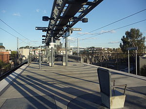
El Segundo station is an elevated light rail station on the K Line of the Los Angeles Metro Rail system. It is located over El Segundo Boulevard, after which the station is named, near its intersection with Nash Street in El Segundo, California. It opened with the commencement of Green Line service on August 12, 1995.[4] The station has been served by the K Line since a restructuring in November 2024.
 El Segundo station platform | |||||||||||||
| General information | |||||||||||||
| Location | 2226 East El Segundo Boulevard El Segundo, California | ||||||||||||
| Coordinates | 33°54′58″N 118°23′13″W / 33.916°N 118.387°W | ||||||||||||
| Owned by | Los Angeles County Metropolitan Transportation Authority | ||||||||||||
| Platforms | 1 island platform | ||||||||||||
| Tracks | 2 | ||||||||||||
| Connections | |||||||||||||
| Construction | |||||||||||||
| Structure type | Elevated | ||||||||||||
| Parking | 93 spaces[1] | ||||||||||||
| Bicycle facilities | Racks and lockers[2] | ||||||||||||
| Accessible | Yes | ||||||||||||
| History | |||||||||||||
| Opened | August 12, 1995 | ||||||||||||
| Previous names |
| ||||||||||||
| Services | |||||||||||||
| |||||||||||||
| |||||||||||||
| |||||||||||||
The station was initially named El Segundo Blvd/Nash St but was later simplified to El Segundo in 2003.[5][6]
The station sits on the northeastern corner of the Raytheon Intelligence & Space campus. It is also close to the Los Angeles Air Force Base, The Aerospace Corporation campus, and the future training facility for the Los Angeles Chargers.
The station is currently the only one on the original El Segundo Green Line alignment with a platform long enough to accommodate a three-car train. The remaining stations are planned to be lengthened by 2028 to accommodate longer three-car trains.[7][8]
Service
editHours and frequency
editK Line service hours are approximately from 4:30 a.m. until 12:00 a.m. daily. Trains operate every 10 minutes throughout the day. Night and early morning weekend service is every 20 minutes.[9]
Connections
editAs of November 3, 2024[update], the following connections are available:[10]
Notable places nearby
editThe station is within walking distance of the following notable places:
References
edit- ^ "Metro Parking Lots by Line". Los Angeles County Metropolitan Transportation Authority. Archived from the original on August 10, 2020. Retrieved November 5, 2021.
- ^ "Secure Bike Parking on Metro" (PDF). Los Angeles County Metropolitan Transportation Authority. Archived from the original (PDF) on September 6, 2021. Retrieved November 5, 2021.
- ^ Allah, Salaam (January 18, 2006). "Image showing El Segundo Blvd/Nash St sign". www.nycsubway.org. Archived from the original on November 13, 2021. Retrieved November 13, 2021.
- ^ "Green Light for the Green Line". The Los Angeles Times. August 12, 1995. Retrieved August 8, 2023 – via Newspapers.com.
- ^ "August 2003 Board Meeting - Item 10" (PDF). Los Angeles County Metropolitan Transportation Authority. August 21, 2003. p. 4. Retrieved March 16, 2024.
- ^ "Metro Bus and Metro Rail System Map - West/Central Los Angeles" (PDF). Los Angeles County Metropolitan Transportation Authority. August 2003. Archived from the original (PDF) on December 12, 2003. Retrieved April 6, 2024.
- ^ Sharp, Steven (January 14, 2020). "Metro Seeks State Funds to Extend Green Line Platforms". Urbanize Los Angeles. Retrieved April 7, 2023.
- ^ Steven, Sharp (April 25, 2023). "State awards more funding for L.A. area transportation projects". Urbanize Los Angeles. Retrieved April 25, 2023.
- ^ "Metro K Line schedule". May 19, 2024. Retrieved December 25, 2023.
- ^ "K Line Timetable – Connections section" (PDF). Los Angeles County Metropolitan Transportation Authority. November 3, 2024. p. 2. Retrieved November 3, 2024.
- ^ "Commuter Express Route 439 Timetable" (PDF). Los Angeles Department of Transportation. July 31, 2021. Retrieved November 3, 2024.
External links
editMedia related to El Segundo (Los Angeles Metro station) at Wikimedia Commons
