
Size of this preview: 800 × 582 pixels. Other resolutions: 320 × 233 pixels | 640 × 465 pixels | 1,055 × 767 pixels.
Original file (1,055 × 767 pixels, file size: 322 KB, MIME type: image/jpeg)
| This is a file from the Wikimedia Commons. Information from its description page there is shown below. Commons is a freely licensed media file repository. You can help. |
Summary
| Description |
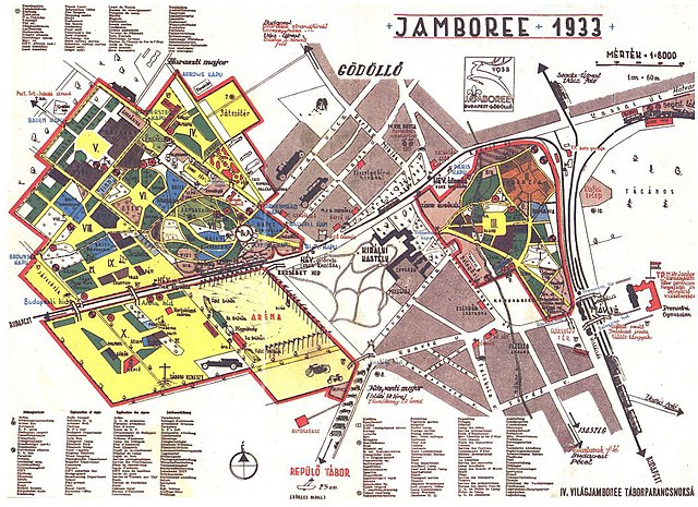
English: Location map and guide to the 4th World Jamboree held in Gödöllő, Hungary from August 2 to August 13, 1933. |
| Date | |
| Source | http://www.bibl.u-szeged.hu/ha/cserkesz/pic/index5.htm |
| Author | Stoits György (?–1947) (?) |
| Other versions | https://maps.hungaricana.hu/hu/HTITerkeptar/35250/?list=eyJxdWVyeSI6ICJGT1JSPShodGkpIn0 |
| Camera location | | View this and other nearby images on: OpenStreetMap |
|---|
Licensing
|
This work is in the public domain in its country of origin and other countries and areas where the copyright term is the author's life plus 70 years or fewer. | |
| This file has been identified as being free of known restrictions under copyright law, including all related and neighboring rights. | |
File history
Click on a date/time to view the file as it appeared at that time.
| Date/Time | Thumbnail | Dimensions | User | Comment | |
|---|---|---|---|---|---|
| current | 20:23, 6 November 2008 | | 1,055 × 767 (322 KB) | Btphelps | {{Information |Description={{en|1=Location map and guide to the 4th World Jamboree held in Gödöllő, Hungary from August 2 to August 13, 1933.}} |Source=http://www.bibl.u-szeged.hu/ha/cserkesz/pic/index5.htm |Author=unknown |Date=1933 |Permission= |othe |
File usage
The following pages on the English Wikipedia use this file (pages on other projects are not listed):
Global file usage
The following other wikis use this file:
- Usage on be-tarask.wikipedia.org
- Usage on be.wikipedia.org
- Usage on cs.wikipedia.org
- Usage on de.wikipedia.org
- Usage on fa.wikipedia.org
- Usage on hu.wikipedia.org
- Usage on pt.wikipedia.org
- Usage on ru.wikipedia.org