Size of this preview: 589 × 599 pixels. Other resolutions: 236 × 240 pixels | 472 × 480 pixels | 746 × 759 pixels.
Original file (746 × 759 pixels, file size: 1.15 MB, MIME type: image/png)
File history
Click on a date/time to view the file as it appeared at that time.
| Date/Time | Thumbnail | Dimensions | User | Comment | |
|---|---|---|---|---|---|
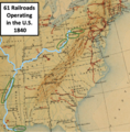
| current | 21:39, 29 February 2024 |  | 746 × 759 (1.15 MB) | TwoScarsUp | Uploaded a work by Prepared under the direction of Balthasar Henry Meyer by Caroline E. MacGill and a staff of collaborators from This map is from the book "History of Transportation in the United States before 1860", published in 1917. It has been modified by TwoScarsUp as a crop of the page with a label, highlighting two rivers, and circling four labels. with UploadWizard |
File usage
The following page uses this file: