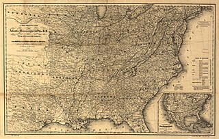
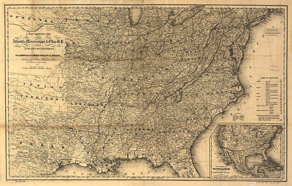
File:A map showing the Atlantic Mississippi & Ohio R.R. and its connections from Norfolk to Cumberland Gap via Bristol.jpg

Size of this preview: 800 × 508 pixels. Other resolutions: 320 × 203 pixels | 640 × 407 pixels | 1,024 × 651 pixels | 1,280 × 813 pixels | 2,549 × 1,620 pixels.
Original file (2,549 × 1,620 pixels, file size: 1.54 MB, MIME type: image/jpeg)
| This is a file from the Wikimedia Commons. Information from its description page there is shown below. Commons is a freely licensed media file repository. You can help. |
Summary
| Description |
English: A map showing the Atlantic Mississippi & Ohio R.R. and its connections from Norfolk to Cumberland Gap via Bristol. |
||
| Date | circa 1867 | ||
| Source |
|
||
| Author |
G.W. & C.B. Colton & Co. Atlantic, Mississippi & Ohio Railroad Company. |

Licensing
|
This work is in the public domain in its country of origin and other countries and areas where the copyright term is the author's life plus 70 years or fewer. This work is in the public domain in the United States because it was published (or registered with the U.S. Copyright Office) before January 1, 1929. | |
| This file has been identified as being free of known restrictions under copyright law, including all related and neighboring rights. | |
File history
Click on a date/time to view the file as it appeared at that time.
| Date/Time | Thumbnail | Dimensions | User | Comment | |
|---|---|---|---|---|---|
| current | 03:22, 29 November 2017 | | 2,549 × 1,620 (1.54 MB) | James Shelton32 | User created page with UploadWizard |
File usage
The following pages on the English Wikipedia use this file (pages on other projects are not listed):