File:A mapp of ye improved part of Pensilvania in America, divided into countyes townships and lotts - cropped, curves.jpg

Size of this preview: 800 × 595 pixels. Other resolutions: 320 × 238 pixels | 640 × 476 pixels | 1,024 × 761 pixels | 1,280 × 951 pixels | 2,560 × 1,903 pixels | 6,466 × 4,806 pixels.
Original file (6,466 × 4,806 pixels, file size: 21.99 MB, MIME type: image/jpeg)
| This is a file from the Wikimedia Commons. Information from its description page there is shown below. Commons is a freely licensed media file repository. You can help. |
Summary
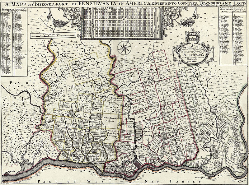
| Description | A mapp of ye improved part of Pensilvania in America, divided into countyes townships and lotts, Surveyed by Thomas Holme for William Penn Esq.. This copy sold by P Lea at Atlas and Hercules in Cheapside. | |||||
| Date | ||||||
| Source |
|
|||||
| Author | Thomas Holme | |||||
| Permission (Reusing this file) |
|
|||||
| Other versions |
 |
|||||


| This is a retouched picture, which means that it has been digitally altered from its original version. Modifications: Cropped, curves. The original can be viewed here: A mapp of ye improved part of Pensilvania in America, divided into countyes townships and lotts.png:
|
File history
Click on a date/time to view the file as it appeared at that time.
| Date/Time | Thumbnail | Dimensions | User | Comment | |
|---|---|---|---|---|---|
| current | 10:36, 29 July 2015 | | 6,466 × 4,806 (21.99 MB) | Storkk | == {{int:filedesc}} == {{Information |Description=A mapp of ye improved part of Pensilvania in America, divided into countyes townships and lotts, Surveyed by Thomas Holmes for [[:en:William Penn|William Penn... |
File usage
The following 3 pages use this file:
Global file usage
The following other wikis use this file:
- Usage on fa.wikipedia.org
- Usage on it.wikipedia.org
- Usage on www.wikidata.org