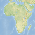
Size of this preview: 605 × 600 pixels. Other resolutions: 242 × 240 pixels | 484 × 480 pixels | 775 × 768 pixels | 1,033 × 1,024 pixels | 2,067 × 2,048 pixels | 2,663 × 2,639 pixels.
Original file (2,663 × 2,639 pixels, file size: 1.66 MB, MIME type: image/png)
File history
Click on a date/time to view the file as it appeared at that time.
| Date/Time | Thumbnail | Dimensions | User | Comment | |
|---|---|---|---|---|---|
| current | 07:41, 12 February 2008 |  | 2,663 × 2,639 (1.66 MB) | Bamse | |
| 03:51, 29 January 2008 |  | 2,663 × 2,639 (1.66 MB) | Bamse | ||
| 09:03, 22 January 2008 |  | 2,663 × 2,639 (1.67 MB) | Bamse | ||
| 05:52, 11 January 2008 |  | 2,728 × 2,703 (1.7 MB) | Bamse | ||
| 05:23, 11 January 2008 |  | 2,728 × 2,703 (1.69 MB) | Bamse | ||
| 04:26, 19 December 2007 |  | 2,500 × 2,479 (2.45 MB) | Bamse | {{Information |Description=topographic map of Africa |Source=self-made |Date=19-12-2007 |Author= Bamse |Permission= |other_versions= }} {{GFDL-GMT}} |
File usage
No pages on the English Wikipedia use this file (pages on other projects are not listed).
Global file usage
The following other wikis use this file:
- Usage on azb.wikipedia.org
- Usage on de.wikipedia.org
- Usage on de.wikiversity.org
- Usage on pt.wikinews.org

