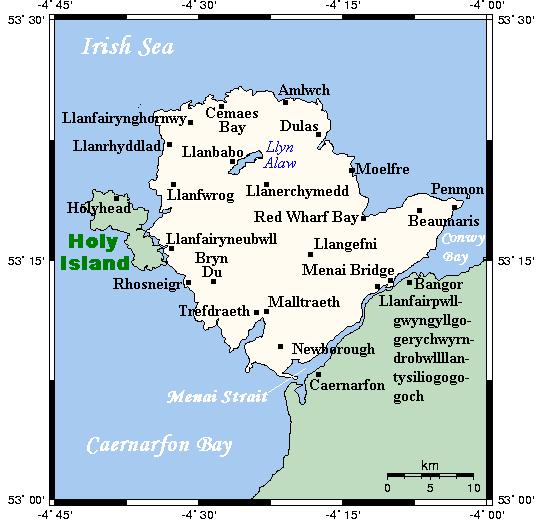
Angleseymôncloseup.png (541 × 522 pixels, file size: 14 KB, MIME type: image/png)
File history
Click on a date/time to view the file as it appeared at that time.
| Date/Time | Thumbnail | Dimensions | User | Comment | |
|---|---|---|---|---|---|
| current | 15:20, 6 April 2013 |  | 541 × 522 (14 KB) | OgreBot | (BOT): Reverting to most recent version before archival |
| 15:20, 6 April 2013 |  | 542 × 522 (13 KB) | OgreBot | (BOT): Uploading old version of file from en.wikipedia; originally uploaded on 2007-07-10 23:02:09 by Kelisi | |
| 15:20, 6 April 2013 |  | 542 × 522 (13 KB) | OgreBot | (BOT): Uploading old version of file from en.wikipedia; originally uploaded on 2007-07-10 22:53:32 by Kelisi | |
| 19:26, 5 April 2013 |  | 541 × 522 (14 KB) | Hogweard | == {{int:filedesc}} == {{Information |Description={{en|A map showing the Isle of Anglesey/Ynys Môn and nearby areas. This map's source is [http://www.aquarius.ifm-geomar.de/ here], with the uploader's modifications, and the [http://gmt.soest.hawaii.ed... |
File usage
The following page uses this file:
Global file usage
The following other wikis use this file:
- Usage on de.wikipedia.org
- Usage on el.wikipedia.org
- Usage on fi.wikipedia.org
- Usage on fr.wikipedia.org
- Usage on nl.wikipedia.org
- Usage on pl.wikipedia.org
- Usage on zh.wikipedia.org

