Size of this preview: 763 × 599 pixels. Other resolutions: 306 × 240 pixels | 611 × 480 pixels | 978 × 768 pixels | 1,268 × 996 pixels.
Original file (1,268 × 996 pixels, file size: 46 KB, MIME type: image/png)
File history
Click on a date/time to view the file as it appeared at that time.
| Date/Time | Thumbnail | Dimensions | User | Comment | |
|---|---|---|---|---|---|
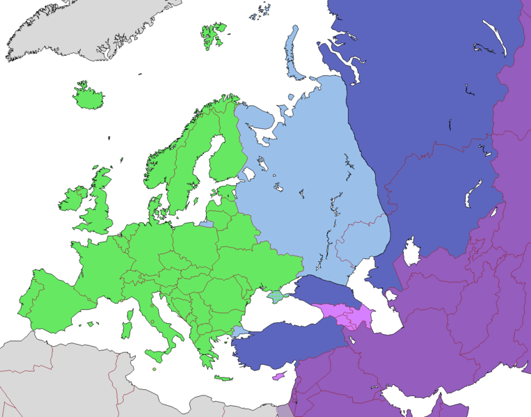
| current | 10:23, 14 November 2022 |  | 1,268 × 996 (46 KB) | Рагин1987 | Highlighted with a light purple hue the countries of Asia, sometimes attributed to Europe according to political, economic, and historical and cultural criteria (Transcaucasia, Cyprus). |
| 12:02, 29 August 2022 |  | 1,268 × 996 (46 KB) | Рагин1987 | Small correction | |
| 07:03, 18 February 2020 |  | 1,268 × 996 (56 KB) | Insider | fix: mixed color. not dark blue | |
| 06:55, 18 February 2020 |  | 1,268 × 996 (60 KB) | Insider | Reverted to version as of 07:01, 13 October 2014 (UTC) Crimea that is Europe | |
| 09:04, 10 February 2020 |  | 1,268 × 996 (84 KB) | Compu wiki | Крым — это Россия. Crimea is Russia. | |
| 07:01, 13 October 2014 |  | 1,268 × 996 (60 KB) | Insider | Reverted to version as of 10:10, 1 July 2014 Crimea that is Europe | |
| 12:31, 11 October 2014 |  | 1,268 × 996 (84 KB) | Michael1238 | Crimea | |
| 10:10, 1 July 2014 |  | 1,268 × 996 (60 KB) | Insider | {{Information |Description={{en|1= Map of Europe, indicating continental boundary and transcontinental states. {{legend|#67e836|States geographically in Europe (excepting overseas possessions; island states UK, Ireland, Iceland and Malta usually group... |
File usage
No pages on the English Wikipedia use this file (pages on other projects are not listed).
Global file usage
The following other wikis use this file:
- Usage on hy.wikipedia.org
- Usage on kk.wikipedia.org
- Usage on ru.wikipedia.org