File:BLM picture of Lower Table Rock.jpg

BLM_picture_of_Lower_Table_Rock.jpg (466 × 317 pixels, file size: 77 KB, MIME type: image/jpeg)


Summary

Description
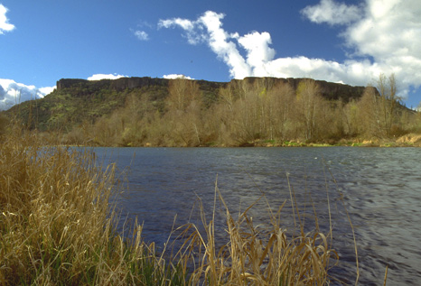
English: Lower Table Rock north of the Rogue River in Jackson County, Oregon
Date Unknown date (Uploaded on Commons at 2011-11-23 04:19:51 (UTC)/Originally uploaded at 2007-11-20 19:37:33)
Source http://www.blm.gov/or/resources/recreation/tablerock/about.php or http://www.blm.gov/or/resources/recreation/tablerock/images/table-splash2-LG.jpg (Originally uploaded on en.wikipedia)
Author Bureau of Land Management (Transferred by Jsayre64/Originally uploaded by Peregrine Fisher)

Licensing

Public domain This image is a work of a Bureau of Land Management* employee, taken or made as part of that person's official duties. As a work of the U.S. federal government, the image is in the public domain in the United States.
*or predecessor organization

Original upload log

The original description page was here. All following user names refer to en.wikipedia.

Upload date | User | Bytes | Dimensions | Comment

  • 2007-11-20 19:37:33 | Peregrine Fisher | 78951 | 466×317 | [[Bereau of Land Management]] picture of lower table rock. Source: http://www.blm.gov/or/resources/recreation/tablerock/images/table-splash2-LG.jpg

Captions

Add a one-line explanation of what this file represents

Items portrayed in this file

depicts

image/jpeg

649f08831ab0dfd635ae432ea5d81ae3726b95e8

78,951 byte

317 pixel

466 pixel

File history

Click on a date/time to view the file as it appeared at that time.

Date/TimeThumbnailDimensionsUserComment
current04:20, 23 November 2011Thumbnail for version as of 04:20, 23 November 2011466 × 317 (77 KB)CommonsHelper2 Bot

The following 2 pages use this file: