Size of this preview: 374 × 599 pixels. Other resolutions: 150 × 240 pixels | 300 × 480 pixels | 480 × 768 pixels | 1,104 × 1,767 pixels.
Original file (1,104 × 1,767 pixels, file size: 705 KB, MIME type: image/jpeg)
Summary
edit
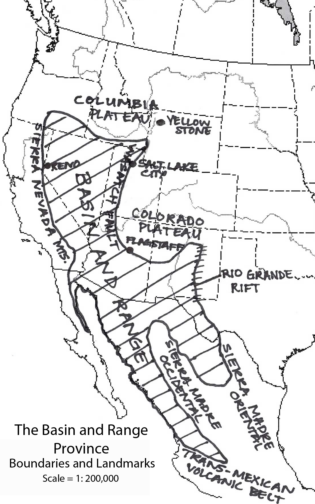
Kathleen Smith, Author/Illustrator
Boundary information compiled from Dickenson, 2002[1]
Note: the Rio Grande rift is shown in the wrong place (it should follow the Rio Grande north from El Paso, but is shown near the Pecos River). There may be other inaccuracies in the map.
References
edit
- ^ Dickinson, William R. "The Basin and Range Province as a Composite Extensional Domain". International Geology Review, Vol. 22, 2002
Licensing
edit
| This work is licensed under the Creative Commons Attribution 3.0 License. |
 | This file is a candidate to be copied to Wikimedia Commons.
Any user may perform this transfer; refer to Wikipedia:Moving files to Commons for details. If this file has problems with attribution, copyright, or is otherwise ineligible for Commons, then remove this tag and DO NOT transfer it; repeat violators may be blocked from editing. Other Instructions
| ||
| |||
File history
Click on a date/time to view the file as it appeared at that time.
| Date/Time | Thumbnail | Dimensions | User | Comment | |
|---|---|---|---|---|---|
| current | 02:32, 6 December 2010 | | 1,104 × 1,767 (705 KB) | Thatmaceguy (talk | contribs) | Kathleen Smith, Author/Illustrator Boundary information compiled from Dickenson, 2002<ref>Dickinson, William R. "The Basin and Range Province as a Composite Extensional Domain". International Geology Review, Vol. 22, 2002</ref> |
You cannot overwrite this file.
File usage
The following pages on the English Wikipedia use this file (pages on other projects are not listed):