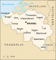
Belgium-map-nl.png (250 × 269 pixels, file size: 62 KB, MIME type: image/png)
File history
Click on a date/time to view the file as it appeared at that time.
| Date/Time | Thumbnail | Dimensions | User | Comment | |
|---|---|---|---|---|---|
| current | 21:21, 13 April 2020 |  | 250 × 269 (62 KB) | Le Fou | Zeebrugge is not a city, but part of the city of Bruges. |
| 19:30, 1 October 2006 |  | 250 × 269 (64 KB) | Electionworld | {{PD-USGov-CIA-WF}} CIA Map of Belgium, translated into Dutch |
File usage
The following page uses this file:
Global file usage
The following other wikis use this file:
- Usage on nn.wikipedia.org
- Usage on no.wikipedia.org

