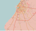
Size of this PNG preview of this SVG file: 712 × 600 pixels. Other resolutions: 285 × 240 pixels | 570 × 480 pixels | 912 × 768 pixels | 1,215 × 1,024 pixels | 2,431 × 2,048 pixels | 978 × 824 pixels.
Original file (SVG file, nominally 978 × 824 pixels, file size: 3.24 MB)
File history
Click on a date/time to view the file as it appeared at that time.
| Date/Time | Thumbnail | Dimensions | User | Comment | |
|---|---|---|---|---|---|
| current | 17:14, 4 January 2018 |  | 978 × 824 (3.24 MB) | MonsterHunter32 | Reverted to version as of 23:43, 22 August 2016 (UTC) so that the readers can see the situation when the battle was occuring. |
| 15:00, 10 November 2017 |  | 1,044 × 879 (3.21 MB) | Kami888 | Revert - turns out Sidi Akribesh was never captured after all | |
| 12:15, 10 July 2017 |  | 1,044 × 879 (3.21 MB) | Kami888 | LNA claims last militants are defeated, the battle is over. https://www.libyaherald.com/2017/07/09/breaking-lna-says-tonight-it-has-taken-last-benghazi-militant-positions/ | |
| 04:06, 7 July 2017 |  | 1,044 × 879 (3.21 MB) | Kami888 | Hospital, hotel, and most of the Sabri district is claimed by LNA. Last militants are holding out in Sidi Akribesh. https://www.libyaherald.com/2017/07/05/breaking-lna-says-benghazis-sabri-has-all-but-fallen/ https://www.libyaherald.com/2017/07/06/lead... | |
| 03:01, 25 June 2017 |  | 1,044 × 879 (3.21 MB) | Kami888 | suddenly... souq al hout and eastern sabri reportedly taken as militants flee. Clashes at Sharif Street in the west and at wahda (sabri branch) bank in the east. https://www.libyaherald.com/2017/06/23/benghazis-suq-al-hout-finally-taken-says-lna-heavin... | |
| 00:20, 22 June 2017 |  | 1,044 × 879 (3.21 MB) | Kami888 | Fish market (Souk al Hout), Erkheis mosque, and much of the Al-Ageeb street is captured. Using a relatively conservative estimate since the capture of the Christian churches has not been reported. https://www.libyaherald.com/2017/06/19/lna-says-it-has-... | |
| 06:40, 19 June 2017 |  | 1,044 × 879 (3.21 MB) | Kami888 | wahda bank & misrata street in souq-al-hout to red https://www.libyaherald.com/2017/06/16/five-lna-soldiers-killed-in-suq-al-hout-offensive/ | |
| 01:21, 15 June 2017 |  | 1,044 × 879 (3.21 MB) | Kami888 | Tahrir square and courthouse captured https://www.libyaherald.com/2017/06/13/benghazis-iconic-tahrir-square-taken-by-lna-as-suq-al-hout-hit-by-airstrikes/ | |
| 08:51, 13 June 2017 |  | 1,044 × 879 (3.21 MB) | Kami888 | Adjusted frontlines based on multiple sources linked in talk page. Also added an unclear area where I just can't figure out what is happening. In line with the similar maps that area is marked in #8080007b. This change does not represent SCBR advance. | |
| 01:25, 23 March 2017 |  | 1,044 × 879 (3.24 MB) | Kami888 | https://www.libyaherald.com/2017/03/18/breaking-ganfouda-12-apartments-complex-finally-taken/ |
File usage
The following page uses this file:
Global file usage
The following other wikis use this file:
- Usage on ar.wikipedia.org
- Usage on be.wikipedia.org
- Usage on es.wikipedia.org
- Usage on fa.wikipedia.org
- Usage on fr.wikipedia.org
- Usage on pt.wikipedia.org
- Usage on ru.wikipedia.org
- Usage on www.wikidata.org


