
Size of this preview: 800 × 378 pixels. Other resolutions: 320 × 151 pixels | 640 × 302 pixels | 1,024 × 484 pixels | 1,280 × 605 pixels | 2,560 × 1,210 pixels | 7,034 × 3,324 pixels.
Original file (7,034 × 3,324 pixels, file size: 10.89 MB, MIME type: image/jpeg)
| This is a file from the Wikimedia Commons. Information from its description page there is shown below. Commons is a freely licensed media file repository. You can help. |
| Description |
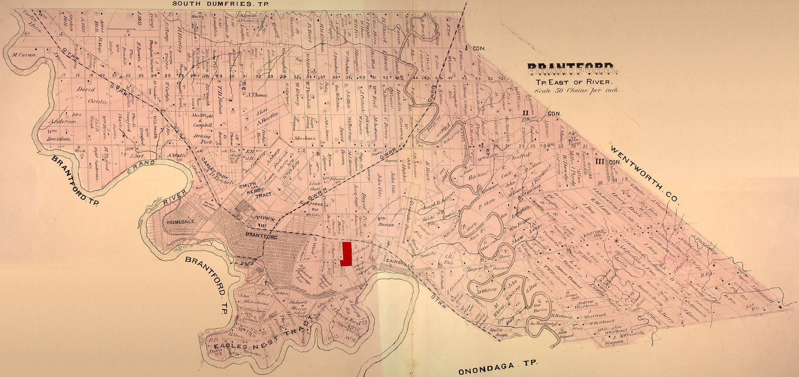
English: Surveyor's Map of Brant County, Ontario, with Echo Place Highlighted in Red |
|||
| Date | circa 1880 | |||
| Source | http://digital.library.mcgill.ca/CountyAtlas/SearchMapframes.php | |||
| Author | Government of Ontario, see http://digital.library.mcgill.ca/CountyAtlas/PrimarySource.htm | |||
| Permission (Reusing this file) |
|

File history
Click on a date/time to view the file as it appeared at that time.
| Date/Time | Thumbnail | Dimensions | User | Comment | |
|---|---|---|---|---|---|
| current | 14:25, 10 July 2008 | | 7,034 × 3,324 (10.89 MB) | WilyD | {{Information |Description={{en|1=Surveyor's Map of Brant County, Ontario, with Echo Place Highlighted in Red}} |Source=http://digital.library.mcgill.ca/CountyAtlas/SearchMapframes.php |Author=Government of Ontario, see http://digital.library.mcgill.ca/Co |
File usage
The following page uses this file: