File:Bristol Channel early 18th century.jpg

Original file (2,231 × 1,900 pixels, file size: 3.51 MB, MIME type: image/jpeg)

Summary

Description
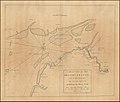
English: This chart is based on a survey by Captain Anselm Holliday of Bristol (died 1729). It was published in an early 18th century maritime atlas.
Date before 1750
date QS:P,+1750-00-00T00:00:00Z/7,P1326,+1750-00-00T00:00:00Z/9
Source https://www.raremaps.com/gallery/detail/47074/a-draught-of-the-bristol-channel-from-the-holmes-to-king-roa-senex-halley-cutler
Author Usually attributed to John Senex, John Harris and Henry Wilson, also Nathanial Cutler. Survey work is by Captain Anselm Holliday, who died in 1729

Licensing

Public domain

This work is in the public domain in its country of origin and other countries and areas where the copyright term is the author's life plus 70 years or fewer.


This work is in the public domain in the United States because it was published (or registered with the U.S. Copyright Office) before January 1, 1929.

This file has been identified as being free of known restrictions under copyright law, including all related and neighboring rights.

Captions

Early 18th century chart of the eastern part of the Bristol Channel

Items portrayed in this file

depicts

image/jpeg

9fd65d1f67b3cf8638632ca6990658624f461508

3,682,031 byte

1,900 pixel

2,231 pixel

File history

Click on a date/time to view the file as it appeared at that time.

Date/TimeThumbnailDimensionsUserComment
current22:36, 12 February 2022Thumbnail for version as of 22:36, 12 February 20222,231 × 1,900 (3.51 MB)ThoughtIdRetiredUploaded a work by Usually attributed to John Senex, John Harris and Henry Wilson, also Nathanial Cutler. Survey work is by Captain Anselm Holliday, who died in 1729 from https://www.raremaps.com/gallery/detail/47074/a-draught-of-the-bristol-channel-from-the-holmes-to-king-roa-senex-halley-cutler with UploadWizard

Metadata