
Size of this preview: 800 × 600 pixels. Other resolutions: 320 × 240 pixels | 640 × 480 pixels | 1,024 × 768 pixels | 1,280 × 960 pixels.
Original file (1,280 × 960 pixels, file size: 891 KB, MIME type: image/jpeg)
| This is a file from the Wikimedia Commons. Information from its description page there is shown below. Commons is a freely licensed media file repository. You can help. |
Summary
| Description |
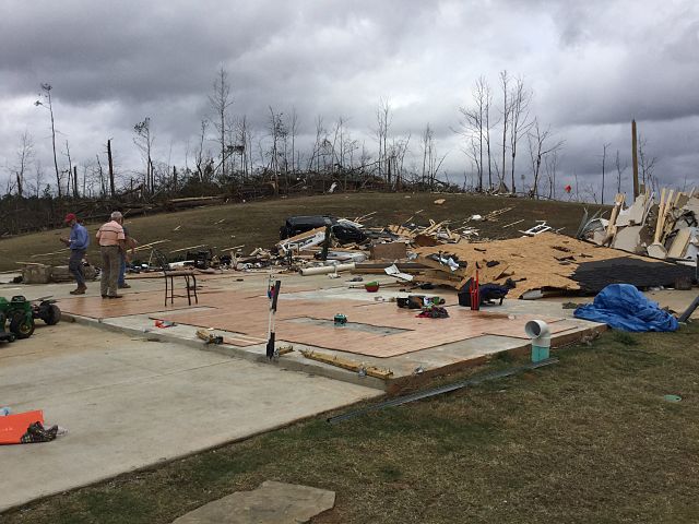
English: EF4 damage to a large house near Canaan, MS. |
| Date | |
| Source | http://services.dat.noaa.gov/arcgis/rest/services/DamageAssessmentToolkit/DamageFlexViewer/FeatureServer/0/883571/attachments/539285 |
| Author | NWS Memphis |
Licensing
This file is in the public domain in the United States because it was solely created by employees of the National Weather Service or National Severe Storms Laboratory using the Damage Assessment Toolkit (DAT), an interactive map and database.
|
File history
Click on a date/time to view the file as it appeared at that time.
| Date/Time | Thumbnail | Dimensions | User | Comment | |
|---|---|---|---|---|---|
| current | 18:29, 28 December 2015 | | 1,280 × 960 (891 KB) | TornadoInformation12 | {{Information |Description ={{en|1=EF4 damage to a large house near Canaan, MS.}} |Source =http://services.dat.noaa.gov/arcgis/rest/services/DamageAssessmentToolkit/DamageFlexViewer/FeatureServer/0/883571/attachments/539285 |Author =... |
File usage
The following pages on the English Wikipedia use this file (pages on other projects are not listed):
Global file usage
The following other wikis use this file:
- Usage on de.wikipedia.org