Size of this preview: 501 × 600 pixels. Other resolutions: 200 × 240 pixels | 401 × 480 pixels | 642 × 768 pixels | 1,275 × 1,526 pixels.
Original file (1,275 × 1,526 pixels, file size: 1.37 MB, MIME type: image/jpeg)
| This is a file from the Wikimedia Commons. Information from its description page there is shown below. Commons is a freely licensed media file repository. You can help. |
Summary
| Description |
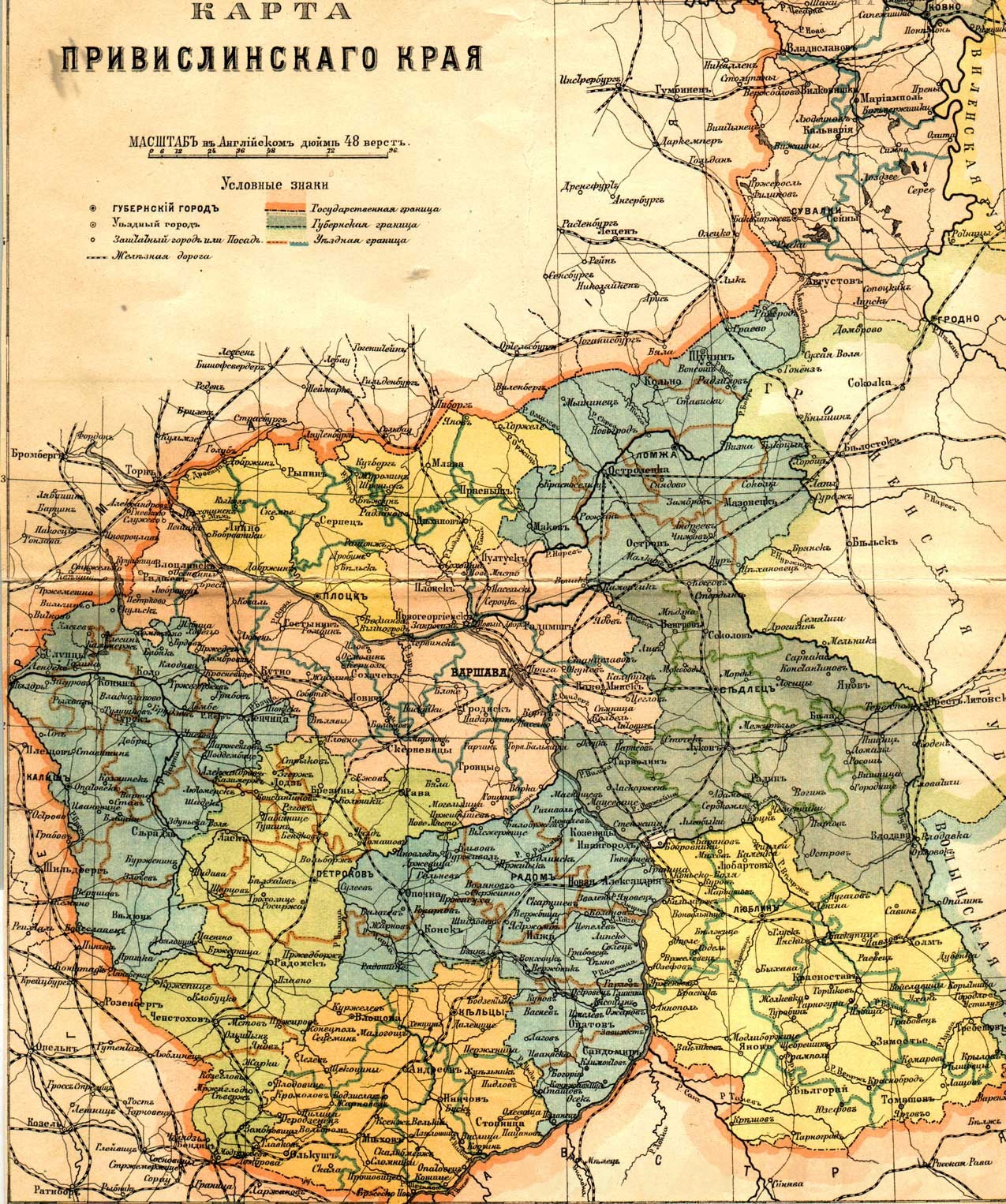
English: Russian map of Vistula land (Privislinsky Krai, former Congress Poland), approx. second half of the 19th century. The scale of the map is 48 versts per English inch. Left column of the legend:
Right column:
|
| Date | |
| Source | [1]/[2] |
| Author | |
| Permission (Reusing this file) |
Public Domain due to age |
| Other versions | File:Privisl.jpg |
![[1]](http://wojtek.onlinesc.net/bebelno/grafika/bebelno_mapa_polski_ii_pol_xix_w.jpg)
Licensing
|
This work is in the public domain in its country of origin and other countries and areas where the copyright term is the author's life plus 70 years or fewer. | |
| This file has been identified as being free of known restrictions under copyright law, including all related and neighboring rights. | |
File history
Click on a date/time to view the file as it appeared at that time.
| Date/Time | Thumbnail | Dimensions | User | Comment | |
|---|---|---|---|---|---|
| current | 19:30, 25 December 2011 | | 1,275 × 1,526 (1.37 MB) | Hic et nunc | removed watermark |
| 19:28, 9 July 2007 |  | 1,275 × 1,526 (471 KB) | Piotrus | {{Information |Description=Russian map of Poland, approx. second half of the 19th century. |Source=[http://wojtek.onlinesc.net/bebelno/grafika/bebelno_mapa_polski_ii_pol_xix_w.jpg]/[http://www.genealogia.ru/projects/maps/maps/map_privisl_jpg.htm] |Date=1 |
File usage
No pages on the English Wikipedia use this file (pages on other projects are not listed).
Global file usage
The following other wikis use this file:
- Usage on br.wikipedia.org
- Usage on de.wikipedia.org
- Usage on hu.wikipedia.org
- Usage on pl.wikipedia.org
- Usage on pt.wikipedia.org
- Usage on ro.wikipedia.org
- Usage on www.wikidata.org