Size of this preview: 515 × 599 pixels. Other resolutions: 206 × 240 pixels | 412 × 480 pixels | 660 × 768 pixels | 1,027 × 1,195 pixels.
Original file (1,027 × 1,195 pixels, file size: 146 KB, MIME type: image/png)
File history
Click on a date/time to view the file as it appeared at that time.
| Date/Time | Thumbnail | Dimensions | User | Comment | |
|---|---|---|---|---|---|
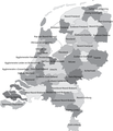
| current | 12:04, 8 January 2011 |  | 1,027 × 1,195 (146 KB) | Classical geographer | Updated Tholen/St. Philipsland (belong to Overig Zeeland, not to Rijnmond). |
| 16:31, 28 July 2010 |  | 1,027 × 1,195 (209 KB) | Classical geographer | Without border. | |
| 16:30, 28 July 2010 |  | 1,102 × 1,300 (211 KB) | Classical geographer | B&W and with more readable labels. | |
| 11:31, 9 July 2009 |  | 1,199 × 1,407 (541 KB) | Classical geographer | Category:Maps of the Netherlands Category:Statistical divisions | |
| 11:30, 9 July 2009 |  | 3,588 × 3,529 (553 KB) | Classical geographer | {{Information |Description={{en|1=Map of the Dutch NUTS3 regions (COROP regions). Made using GIS software.}} |Source=Own work by uploader |Author=Classical geographer |Date=2009-07-09 |Permission= |other_versions= }} [[Categ |
File usage
The following 2 pages use this file:
Global file usage
The following other wikis use this file:
- Usage on ar.wikipedia.org
- Usage on ca.wikipedia.org
- Usage on es.wikipedia.org
- Usage on fr.wikipedia.org
- Usage on nl.wikipedia.org