Size of this preview: 669 × 600 pixels. Other resolutions: 268 × 240 pixels | 535 × 480 pixels | 696 × 624 pixels.
Original file (696 × 624 pixels, file size: 60 KB, MIME type: image/png)
File history
Click on a date/time to view the file as it appeared at that time.
| Date/Time | Thumbnail | Dimensions | User | Comment | |
|---|---|---|---|---|---|
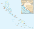
| current | 10:51, 6 March 2023 |  | 696 × 624 (60 KB) | Nihil scimus | Paklinski + Jelenski otoci |
| 19:56, 5 March 2023 |  | 696 × 600 (58 KB) | Nihil scimus | Contrast, Palagruza Is., continents added. | |
| 19:39, 1 March 2006 |  | 696 × 600 (49 KB) | Jelte | Map of the w:Croatian w:islands Adapted from http://www.un.org/Depts/Cartographic/map/profile/croatia.pdf and Image:Hr-map.png {{PD-because|Mapping derived from products of the [http://www.un.org/Depts/Cartographic/english/htmain.htm Unite |
File usage
The following 2 pages use this file:
Global file usage
The following other wikis use this file:
- Usage on ar.wikipedia.org
- Usage on avk.wikipedia.org
- Molat (ewala)
- Teza:XrvatskaEwala
- Ist (ewala)
- Škarda (ewala)
- Kamenjak (ewala)
- Maslinjak (ewala)
- Vodenjak (ewala)
- Benušić (ewala)
- Črnikovac (ewala)
- Dužac (ewala)
- Sestrice (ewala)
- Križica (ewala)
- Tramerka (ewala)
- Tramerčica (ewala)
- Obljak (ewala)
- Knežačić (ewala)
- Tovarnjak (ewala)
- Mladinj (ewala)
- Rižnjak (ewala)
- Lušnjak-Kamenjak (ewala)
- Brgulje Otočić (ewala)
- Premuda (ewala)
- Hripa (ewala)
- Bračići (ewala)
- Masarine (ewala)
- Plitka Sika (ewala)
- Lutrošnjak (ewala)
- Kamenjak (ewala poke Premuda)
- Silba (ewala)
- Olib (ewala)
- Morovnik (ewala)
- Šip (ewala)
- Kurjak (ewala)
- Maun (ewala)
- Škrda (ewala)
- Veli Brušnjak (ewala)
- Mali Brušnjak (ewala)
- Lukar (ewala)
- Pohlib (ewala)
- Kornat (ewalatum)
- Kornat (ewala)
- Svršata Vela (ewala)
- Svršata Mala (ewala)
- Buč Veli (ewala)
- Buč Mali (ewala)
- Krpeljina (ewala)
- Bisaga (ewala poke Kornat)
- Ravna Sika (ewala poke Kornat)
- Strižnjak (ewala)
View more global usage of this file.

