Size of this preview: 654 × 599 pixels. Other resolutions: 262 × 240 pixels | 524 × 480 pixels | 838 × 768 pixels | 1,117 × 1,024 pixels | 2,235 × 2,048 pixels | 6,272 × 5,748 pixels.
Original file (6,272 × 5,748 pixels, file size: 13 MB, MIME type: image/jpeg)
File history
Click on a date/time to view the file as it appeared at that time.
| Date/Time | Thumbnail | Dimensions | User | Comment | |
|---|---|---|---|---|---|
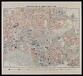
| current | 20:12, 21 October 2014 |  | 6,272 × 5,748 (13 MB) | Fæ | =={{int:filedesc}}== {{Artwork |artist = |author = |title = Descriptive map of London poverty, 1889. |description = Descriptive map of London poverty, 1889. North-Eastern sheet, comprising parts of Hackney, I... |
File usage
No pages on the English Wikipedia use this file (pages on other projects are not listed).
Global file usage
The following other wikis use this file:
- Usage on es.wikipedia.org


