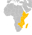
Eastern-Africa-map.PNG (360 × 392 pixels, file size: 10 KB, MIME type: image/png)
File history
Click on a date/time to view the file as it appeared at that time.
| Date/Time | Thumbnail | Dimensions | User | Comment | |
|---|---|---|---|---|---|
| current | 18:41, 17 March 2018 |  | 360 × 392 (10 KB) | Maphobbyist | Montenegro border |
| 03:49, 21 December 2012 |  | 360 × 392 (8 KB) | Spacepotato | Recolor South Sudan, since in the current version of the UN geographic classification scheme, http://unstats.un.org/unsd/methods/m49/m49regin.htm , South Sudan has been placed in Eastern Africa. | |
| 20:58, 9 July 2011 |  | 360 × 392 (13 KB) | Maphobbyist | South Sudan has become independent on July 9, 2011. Sudan and South Sudan are shown with the new international border between them. | |
| 13:30, 7 December 2007 |  | 360 × 392 (14 KB) | Vervictorio | {{Information |Description=The map of Africa |Source=Own work |Date=2007.12.07. |Author=Vervictorio |Permission=See below. |other_versions= }} Category:Maps of Africa |
File usage
The following 4 pages use this file:
Global file usage
The following other wikis use this file:
- Usage on ab.wikipedia.org
- Usage on am.wikipedia.org
- Usage on ar.wikipedia.org
- Usage on de.wikipedia.org
- Usage on de.wikivoyage.org
- Usage on diq.wikipedia.org
- Usage on el.wikipedia.org
- Usage on et.wikipedia.org
- Usage on fa.wikipedia.org
- Usage on fi.wikipedia.org
- Usage on hu.wikipedia.org
- Algéria címere
- Angola címere
- Kenya címere
- Benin címere
- Bissau-Guinea címere
- Botswana címere
- Burkina Faso címere
- Burundi címere
- Comore-szigetek címere
- Csád címere
- A Dél-afrikai Köztársaság címere
- Szent Ilona címere
- Dzsibuti címere
- Egyenlítői-Guinea címere
- Egyiptom címere
- Elefántcsontpart címere
- Eritrea címere
- Etiópia címere
- Gabon címere
- Gambia címere
- Ghána címere
- Guinea címere
- Kamerun címere
- A Kongói Köztársaság címere
- A Közép-afrikai Köztársaság címere
- Lesotho címere
- Libéria címere
- Líbia címere
- Sablon:Afrika címerei
- Madagaszkár címere
- Malawi címere
- Mali címere
- Marokkó címere
- Mauritánia címere
- Mauritius címere
- Mozambik címere
- Namíbia címere
- Niger címere
View more global usage of this file.

