File:European Union Faroe Islands Locator.svg

Original file (SVG file, nominally 1,760 × 1,560 pixels, file size: 718 KB)

Summary

Description
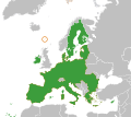
English: Map of the European Union and the Faroe Islands
Date
Source Derivative from a commons map
Author Chipmunkdavis at English Wikipedia

Licensing

© The copyright holder of this file, Chipmunkdavis at en.wikipedia, allows anyone to use it for any purpose, provided that the copyright holder is properly attributed. Redistribution, derivative work, commercial use, and all other use is permitted.
Attribution:

Warning sign
This file may not have the correct information on its copyright status.
The reason given by the user who added this tag is: current version (2015-03-18) appears to be an uncredited derivative work of File:Blank_map_of_Europe.svg, which is licensed under the Creative Commons Attribution-Share Alike 2.5 Generic licence licence.


This template should be used when a file's licensing information seems to be incorrect or inaccurate, to prompt discussion or review by other editors. An experienced editor should contact the uploader and add the proper license tag, or discuss the issue on the talk page.

Notify the uploader with:
{{subst:Wrong license note|1=File:European Union Faroe Islands Locator.svg|2=current version (2015-03-18) appears to be an uncredited derivative work of File:Blank_map_of_Europe.svg, which is licensed under the Creative Commons Attribution-Share Alike 2.5 Generic licence licence.}} ~~~~


  • If this file has insufficient source information, use {{subst:nsd}}.
  • If this file does not have a sufficient claim of permission, use {{subst:npd}}.
  • If this file is a blatant copyright infringement, use {{Copyvio}}.
  • If this file is non-free per Commons:Licencing, start a deletion request.

Items tagged with this template are sorted into Category:Items with disputed copyright information.


العربية  Zazaki  English  español  français  italiano  日本語  മലയാളം  polski  português  русский  sicilianu  slovenščina  svenska  Tiếng Việt  简体中文  繁體中文  +/−

Original upload log

Transferred from en.wikipedia to Commons by Innotata using CommonsHelper.

The original description page was here. All following user names refer to en.wikipedia.
  • 2010-08-21 13:05 Chipmunkdavis 680×520× (468771 bytes) {{Information |Description = Map of the European Union and the Faroe Islands |Source = Derivative from a commons map |Date = ~~~~~ |Author = |Permission = |other_versions = }}

Captions

Add a one-line explanation of what this file represents

Items portrayed in this file

depicts

21 August 2010

image/svg+xml

File history

Click on a date/time to view the file as it appeared at that time.

Date/TimeThumbnailDimensionsUserComment
current09:50, 27 March 2020Thumbnail for version as of 09:50, 27 March 20201,760 × 1,560 (718 KB)HogweardUpdate
17:52, 26 October 2016Thumbnail for version as of 17:52, 26 October 2016680 × 520 (604 KB)Giorgi BalakhadzeRv of sockpuppet and per COM:OVERWRITE
18:41, 18 March 2015Thumbnail for version as of 18:41, 18 March 2015680 × 520 (621 KB)LeftcryUpdate layout
19:46, 16 January 2015Thumbnail for version as of 19:46, 16 January 2015680 × 520 (425 KB)Danlaycockrm Croatia's border
20:41, 12 January 2015Thumbnail for version as of 20:41, 12 January 2015680 × 520 (458 KB)Edroeh+ Croatia + Kroatien
20:38, 12 January 2015Thumbnail for version as of 20:38, 12 January 2015680 × 520 (458 KB)Edroeh+ Croatia + Kroatien
23:23, 8 February 2011Thumbnail for version as of 23:23, 8 February 2011680 × 520 (458 KB)File Upload Bot (Magnus Manske) {{BotMoveToCommons|en.wikipedia|year={{subst:CURRENTYEAR}}|month={{subst:CURRENTMONTHNAME}}|day={{subst:CURRENTDAY}}}} {{Information |Description={{en|Map of the European Union and the Faroe Islands}} |Source=Transferred from [http://en.wikipedia.org en.

The following page uses this file:

Global file usage

The following other wikis use this file:

Metadata