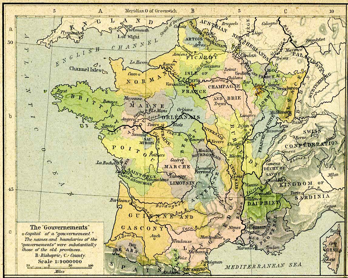
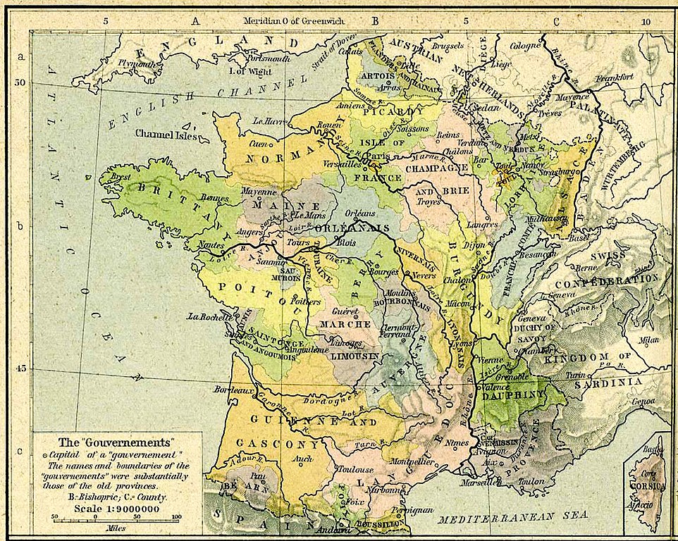
Size of this preview: 751 × 600 pixels. Other resolutions: 301 × 240 pixels | 601 × 480 pixels | 962 × 768 pixels | 1,147 × 916 pixels.
Original file (1,147 × 916 pixels, file size: 343 KB, MIME type: image/jpeg)
| This is a file from the Wikimedia Commons. Information from its description page there is shown below. Commons is a freely licensed media file repository. You can help. |
Summary
| Description |
Français : Carte des anciens gouvernements français en 1789 in The Historical Atlas by William R. Shepherd, 1926
(Les provinces ont des frontières différentes) |
||||
| Date | |||||
| Source | The Historical Atlas | ||||
| Author | William R. Shepherd | ||||
| Permission (Reusing this file) |
|
||||
Licensing
|
This work is in the public domain in its country of origin and other countries and areas where the copyright term is the author's life plus 70 years or fewer. | |
| This file has been identified as being free of known restrictions under copyright law, including all related and neighboring rights. | |
Original upload log
The original description page was here. All following user names refer to fr.wikipedia.
- 2006-03-11 14:41 Tournachon 1147×916×??? (351339 bytes)
File history
Click on a date/time to view the file as it appeared at that time.
| Date/Time | Thumbnail | Dimensions | User | Comment | |
|---|---|---|---|---|---|
| current | 08:46, 22 September 2008 | | 1,147 × 916 (343 KB) | File Upload Bot (Magnus Manske) | {{BotMoveToCommons|fr.wikipedia}} {{Information |Description={{fr|Carte des anciens gouvernements français en 1789 in The Historical Atlas by William R. Shepherd, 1926 ''(Les provinces ont des frontières différentes)'' == Licence == [[:fr:Cat� |
File usage
The following pages on the English Wikipedia use this file (pages on other projects are not listed):
Global file usage
The following other wikis use this file:
- Usage on ar.wikipedia.org
- Usage on arz.wikipedia.org
- Usage on azb.wikipedia.org
- Usage on bg.wikipedia.org
- Usage on br.wikipedia.org
- Usage on cv.wikipedia.org
- Usage on el.wikipedia.org
- Usage on en.wikiquote.org
- Usage on eo.wikipedia.org
- Usage on fi.wikipedia.org
- Usage on fr.wikipedia.org
- Toul
- Gascogne
- Histoire du département des Ardennes
- Territoires du royaume de France
- Armorial des familles de France
- Discussion Projet:Aquitaine/archives
- Histoire de l'Occitanie
- Portail:Pays de la Loire
- Portail:Pays de la Loire/Sélection
- Armorial des familles d'Île-de-France
- Armorial des familles de Bourgogne
- Usage on it.wikipedia.org
- Usage on lt.wikipedia.org
- Usage on nl.wikipedia.org
- Usage on nn.wikipedia.org
- Usage on ru.wikipedia.org
View more global usage of this file.