Size of this preview: 533 × 600 pixels. Other resolutions: 213 × 240 pixels | 427 × 480 pixels | 801 × 901 pixels.
Original file (801 × 901 pixels, file size: 30 KB, MIME type: image/png)
File history
Click on a date/time to view the file as it appeared at that time.
| Date/Time | Thumbnail | Dimensions | User | Comment | |
|---|---|---|---|---|---|
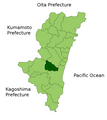
| current | 19:33, 22 March 2010 |  | 801 × 901 (30 KB) | Alberth2 | Nojiri Town was mereged into Kobayashi City and Kiyotake Town was mereged into Miyazaki City. |
| 08:17, 31 March 2009 |  | 801 × 901 (31 KB) | Alberth2 | Nangou-chō, Kitagou-chō and Nichinan-shi were megred. | |
| 09:25, 26 September 2008 |  | 801 × 901 (31 KB) | Alberth2 | == Summary == {{Information |Description=Location Map of Higashimorokata District in Miyazaki Prefecture, Japan |Source=Image:MiyazakiMapCurrent.png and rework |Date=Sep. 26th, 2008 |Author=user:alberth2 |Permission=PD |other_versions= }} == Lic |
File usage
The following page uses this file:
Global file usage
The following other wikis use this file:
- Usage on fa.wikipedia.org
- Usage on fr.wikipedia.org
- Usage on id.wikipedia.org
- Usage on it.wikipedia.org
- Usage on sr.wikipedia.org
- Usage on www.wikidata.org
- Usage on zh-yue.wikipedia.org
- Usage on zh.wikipedia.org