
Size of this preview: 746 × 600 pixels. Other resolutions: 299 × 240 pixels | 597 × 480 pixels | 956 × 768 pixels | 1,274 × 1,024 pixels | 2,548 × 2,048 pixels | 5,500 × 4,421 pixels.
Original file (5,500 × 4,421 pixels, file size: 3.87 MB, MIME type: image/jpeg)
| This is a file from the Wikimedia Commons. Information from its description page there is shown below. Commons is a freely licensed media file repository. You can help. |
Summary
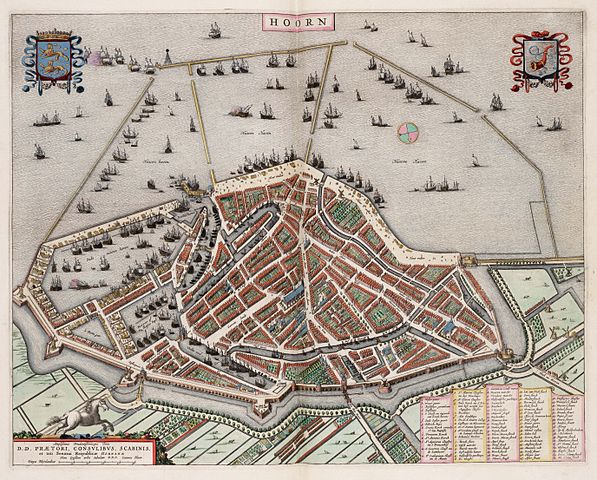
| Description | A map of Hoorn (NH, The Netherlands) | ||||
| Date | |||||
| Source | Atlas Van Loon | ||||
| Author | Johannes Blaeu | ||||
| Permission (Reusing this file) |
|
||||
| Other versions |
.jpg) |
||||
| Camera location | | View this and other nearby images on: OpenStreetMap |
|---|
File history
Click on a date/time to view the file as it appeared at that time.
| Date/Time | Thumbnail | Dimensions | User | Comment | |
|---|---|---|---|---|---|
| current | 13:47, 7 May 2010 | | 5,500 × 4,421 (3.87 MB) | Erik Baas | == {{int:filedesc}} == {{Information |Description=A map of Hoorn (NH, The Netherlands) |Source=[http://www.let.rug.nl/~maps/ University of Groningen] |Date=1649 |Author=Johannes Blaeu |Permission={{PD-old}} |other_versions= }} == {{int:license}} == {{PD- |
File usage
The following page uses this file:
Global file usage
The following other wikis use this file:
- Usage on nl.wikipedia.org
- Usage on sl.wikipedia.org