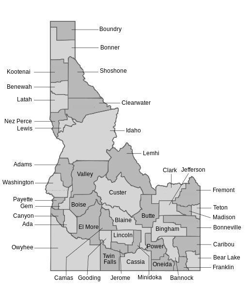
Size of this PNG preview of this SVG file: 516 × 600 pixels. Other resolutions: 206 × 240 pixels | 413 × 480 pixels | 660 × 768 pixels | 881 × 1,024 pixels | 1,761 × 2,048 pixels | 860 × 1,000 pixels.
Original file (SVG file, nominally 860 × 1,000 pixels, file size: 2.04 MB)
File history
Click on a date/time to view the file as it appeared at that time.
| Date/Time | Thumbnail | Dimensions | User | Comment | |
|---|---|---|---|---|---|
| current | 21:33, 11 January 2009 |  | 860 × 1,000 (2.04 MB) | ZooFari | {{Information |Description= |Source= |Date= |Author= |Permission= |other_versions= }} |
| 21:26, 11 January 2009 |  | 860 × 1,000 (2.04 MB) | ZooFari | {{Information |Description= |Source= |Date= |Author= |Permission= |other_versions= }} | |
| 21:17, 11 January 2009 |  | 900 × 1,054 (2.03 MB) | ZooFari | {{Information |Description={{en|1=Map of all the counties in Idaho}} |Source=Own work by uploader |Author=ZooFari |Date=January 11, 08 |Permission= |other_versions= }} <!--{{ImageUpload|full}}--> Category:Idaho Category:Counties |
File usage
The following 7 pages use this file:
- Geography of Idaho
- Wikipedia:Featured picture candidates/January-2009
- Wikipedia:Featured picture candidates/Map of Idaho counties
- Wikipedia:Picture peer review/Archives/Jan-Mar 2009
- Wikipedia:Picture peer review/Idaho counties map
- Wikipedia:Valued picture candidates/Idaho counties
- Wikipedia:Valued picture candidates/January-2009
