Size of this preview: 603 × 600 pixels. Other resolutions: 241 × 240 pixels | 483 × 480 pixels | 772 × 768 pixels | 1,030 × 1,024 pixels | 2,060 × 2,048 pixels | 5,290 × 5,260 pixels.
Original file (5,290 × 5,260 pixels, file size: 10.43 MB, MIME type: image/jpeg)
File history
Click on a date/time to view the file as it appeared at that time.
| Date/Time | Thumbnail | Dimensions | User | Comment | |
|---|---|---|---|---|---|
| current | 13:53, 27 April 2019 |  | 5,290 × 5,260 (10.43 MB) | Ras67 | high resolution |
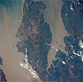
| 14:53, 8 March 2011 |  | 640 × 480 (31 KB) | Micael 106 | {{Information |Description ={{en|1=Landast of Island São Luís, Maranhão, Brazil. }} {{pt|1=Imagem de satélite da Ilha de São Luís (Upaon-açu), Maranhão, Brasil.}} |Source =[http://eol.jsc.nasa.gov/scripts/sseop/QuickView.pl?directory=IS |
File usage
The following page uses this file:
Global file usage
The following other wikis use this file:
- Usage on es.wikipedia.org
- Usage on ko.wikipedia.org
- Usage on nl.wikipedia.org
- Usage on pt.wikipedia.org
- Usage on sh.wikipedia.org