
Size of this preview: 800 × 538 pixels. Other resolutions: 320 × 215 pixels | 640 × 430 pixels | 1,024 × 688 pixels | 1,351 × 908 pixels.
Original file (1,351 × 908 pixels, file size: 1.01 MB, MIME type: image/jpeg)
| This is a file from the Wikimedia Commons. Information from its description page there is shown below. Commons is a freely licensed media file repository. You can help. |
Summary
| Description |
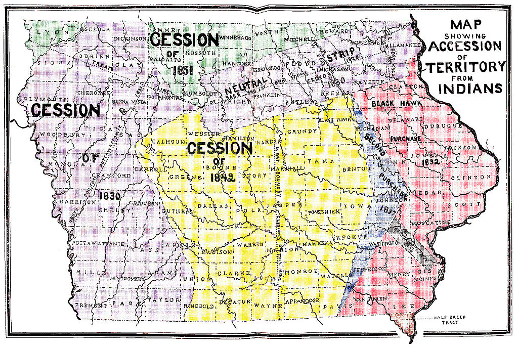
English: "Map Showing Accession of Territory from Indians" from the original instructions for the Census of Iowa for the Year 1905, Published: 1905-1906, Des Moines, Iowa, Bernard Murphy, State Printer; Under the authority of chapter 8, acts of the 30th general assembly, page iii |
| Date | |
| Source | http://iagenweb.org/census/1905/index.html |
| Author | Iowa State Executive Council for the Iowa Secretary of State |
| Other versions |
.jpg)
Licensing
This media file is in the public domain in the United States. This applies to U.S. works where the copyright has expired, often because its first publication occurred prior to January 1, 1929, and if not then due to lack of notice or renewal. See this page for further explanation.
|
 | |
 |
File history
Click on a date/time to view the file as it appeared at that time.
| Date/Time | Thumbnail | Dimensions | User | Comment | |
|---|---|---|---|---|---|
| current | 06:10, 21 February 2012 | | 1,351 × 908 (1.01 MB) | Charvex |
File usage
No pages on the English Wikipedia use this file (pages on other projects are not listed).
Global file usage
The following other wikis use this file:
- Usage on fr.wikipedia.org
- Usage on ja.wikipedia.org
- Usage on ro.wikipedia.org
- Usage on zh.wikipedia.org