
Size of this PNG preview of this SVG file: 672 × 600 pixels. Other resolutions: 269 × 240 pixels | 538 × 480 pixels | 860 × 768 pixels | 1,147 × 1,024 pixels | 2,294 × 2,048 pixels | 1,372 × 1,225 pixels.
Original file (SVG file, nominally 1,372 × 1,225 pixels, file size: 374 KB)
| This is a file from the Wikimedia Commons. Information from its description page there is shown below. Commons is a freely licensed media file repository. You can help. |
| Description |
Quadratische Plattkarte, N-S-Streckung 115 %. Geographische Begrenzung der Karte:
Equirectangular projection, N/S stretching 115 %. Geographic limits of the map:
|
| Date | |
| Source |
own work, using
|
| Author | NordNordWest |
| Other versions |
|


|
This map has been made or improved in the German Kartenwerkstatt (Map Lab). You can propose maps to improve as well.
|
Licensing
I, the copyright holder of this work, hereby publish it under the following licenses:

|
Permission is granted to copy, distribute and/or modify this document under the terms of the GNU Free Documentation License, Version 1.2 or any later version published by the Free Software Foundation; with no Invariant Sections, no Front-Cover Texts, and no Back-Cover Texts. A copy of the license is included in the section entitled GNU Free Documentation License. |
This file is licensed under the Creative Commons Attribution-Share Alike 3.0 Unported license.
- You are free:
- to share – to copy, distribute and transmit the work
- to remix – to adapt the work
- Under the following conditions:
- attribution – You must give appropriate credit, provide a link to the license, and indicate if changes were made. You may do so in any reasonable manner, but not in any way that suggests the licensor endorses you or your use.
- share alike – If you remix, transform, or build upon the material, you must distribute your contributions under the same or compatible license as the original.
You may select the license of your choice.
File history
Click on a date/time to view the file as it appeared at that time.
| Date/Time | Thumbnail | Dimensions | User | Comment | |
|---|---|---|---|---|---|
| current | 02:32, 25 October 2017 | | 1,372 × 1,225 (374 KB) | Rob984 | minor |
| 02:15, 25 October 2017 |  | 1,372 × 1,225 (374 KB) | Rob984 | minor fixes | |
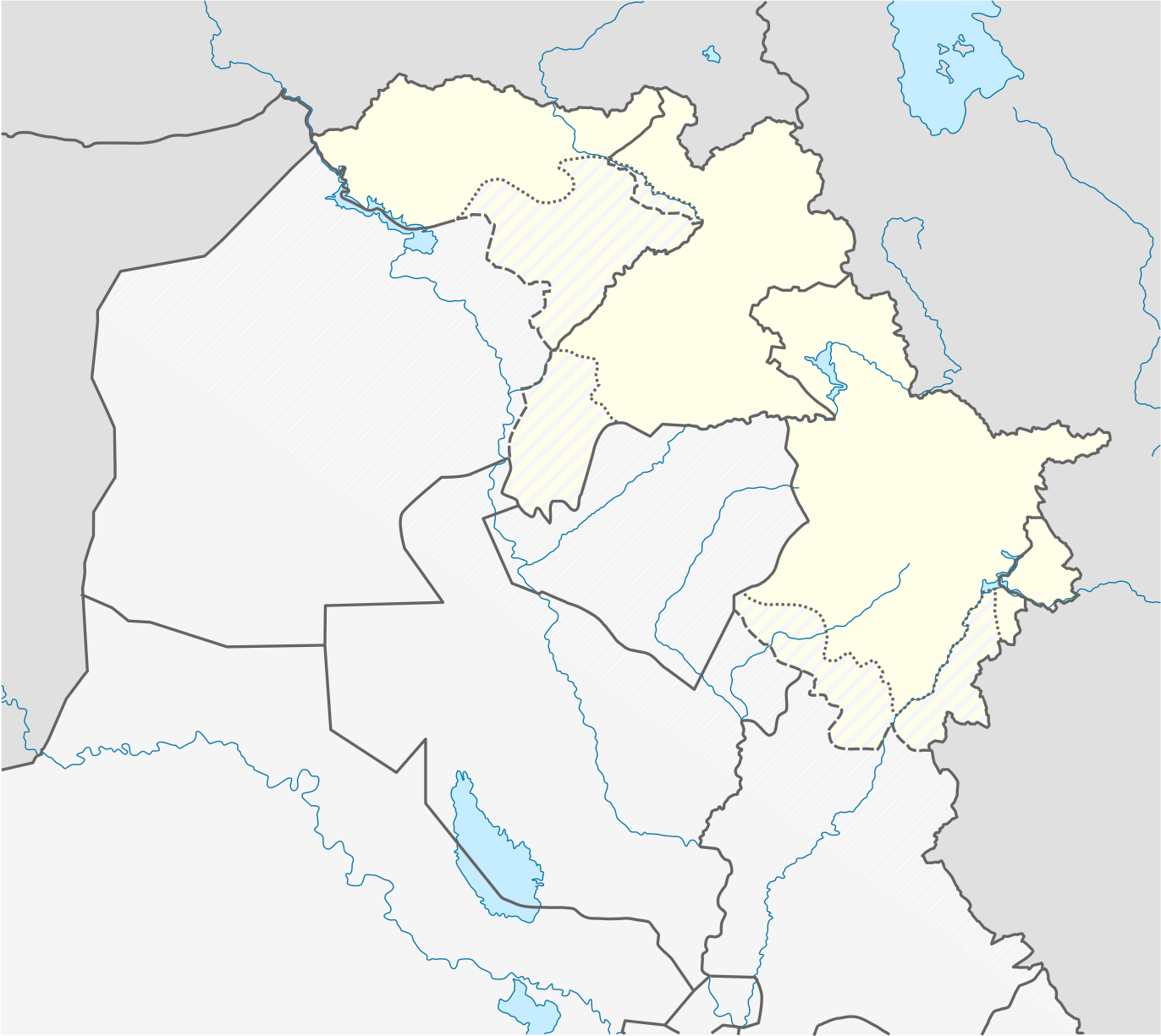
| 01:34, 25 October 2017 |  | 1,372 × 1,225 (413 KB) | Rob984 | I've updated the official borders according to the KRG per http://www.krso.net/files/articles/071015030355.jpg I've also indicated the disputed territories within the official borders, as the federal government has not agreed to these borders or the... | |
| 01:03, 13 June 2014 |  | 1,372 × 1,225 (277 KB) | Spesh531 | adding halabja | |
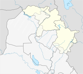
| 18:33, 27 May 2009 |  | 1,372 × 1,225 (273 KB) | NordNordWest | {{Information |Description= {{de|Positionskarte der Autonomen Region Kurdistan, Irak}} Quadratische Plattkarte, N-S-Streckung 115 %. Geographische Begrenzung der Karte: * N: 37.7° N * S: 33.2° N * W: 40.8° |
File usage
The following 71 pages use this file:
- 2024 CONIFA World Football Cup
- Ain Sifni
- Alikhan (village)
- Ankawa
- Araden
- Armota
- Avzrog
- Az Zibar
- Badarash
- Bahzani
- Bakhetme
- Bamarni
- Bamarni Air Base
- Banoka
- Bardarash
- Bassetki
- Batel
- Batifa
- Bawanur Dam
- Betanure
- Chamchamal
- Darbandikhan
- Darbandokeh
- Dayrabun
- Dehi, Iraq
- Dekon
- Dera Shish
- Deraluk
- Dere, Iraq
- Dooreh, Iraq
- Duhok International Airport
- English Village, Erbil
- Erbil
- Erbil International Airport
- Geldara
- Harir, Iraq
- Hezany
- Jelek, Iraq
- Kani Masi
- Kelkan
- Khalifan, Erbil
- Khinnis Reliefs
- Komane, Iraq
- Kurdish Heritage Institute
- Mangesh, Iraq
- Mawat, Iraq
- Mount Butin
- Mount Korek
- Mount Shabani
- Pendro
- Qaladiza
- Qarachatan
- Qaradagh District
- Ranya
- Said Sadiq
- Sarsing
- Segrdkan, Iraq
- Shaqlawa
- Shaqlawa District
- Sharanish
- Simele
- Sulaimaniyah International Airport
- Sulaymaniyah
- Zawita
- User:BethKhira/sandbox
- User:Jwslubbock/sandbox11
- User:Shcha1234/sandbox/test
- User:User6000000/sandbox
- Draft:Takya, Kurdistan Region
- Module:Location map/data/Iraqi Kurdistan
- Module:Location map/data/Iraqi Kurdistan/doc
Global file usage
The following other wikis use this file:
- Usage on ar.wikipedia.org
- Usage on azb.wikipedia.org
- Usage on ba.wikipedia.org
- Usage on bg.wikipedia.org
- Usage on ckb.wikipedia.org
- ھەڵەبجە
- کەرکووک
- داڕێژە:دابەشکارییە کارگێڕییەکانی ھەرێمی کوردستان
- پارێزگای سلێمانی
- پارێزگای ھەولێر
- پارێزگای دھۆک
- خانەقین
- کۆیە
- دھۆک
- ڕەواندز
- مووسڵ
- قەزای سەید سادق
- کفری
- پردێ
- ھەولێر
- داقووق
- سلێمانی
- تەقتەق
- کەلار
- ئیدارەی گەرمیان
- قەزای ھەولێر
- قەزای شەقڵاوە
- قەزای سۆران
- قەزای مێرگەسۆر
- قەزای چۆمان
- قەزای دەشتی ھەولێر
- خەبات (قەزا)
- مەخموور
- قەزای کۆیە
- قەزای ڕەواندز
- پۆل:قەزاکانی کوردستان
- قەزای دەربەندیخان
- داڕێژە:نەخشەی باشووری کوردستان
- چنارۆک
- خەلیفان، ھەولێر
- داڕێژە:نەخشەی ھەرێمی کوردستان
- عەبابەیلێ
- نازەنین، ھیران
- قەزای مەخموور
- بەرزنجە
- قەزای دووکان
- قەزای خەبات
- قەزای پێنجوێن
- قەزای شارەزوور
- قەزای ھەڵەبجە
View more global usage of this file.