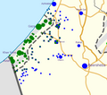
Israel-war-Oct-8-2023.png (528 × 468 pixels, file size: 61 KB, MIME type: image/png)
File history
Click on a date/time to view the file as it appeared at that time.
| Date/Time | Thumbnail | Dimensions | User | Comment | |
|---|---|---|---|---|---|
| current | 00:23, 9 October 2023 |  | 528 × 468 (61 KB) | Veggies | New settlements and cities added, radii resized per poulation |
| 19:23, 8 October 2023 |  | 512 × 494 (60 KB) | Veggies | Towns recaptured, others evacuated | |
| 07:10, 8 October 2023 |  | 520 × 500 (40 KB) | Veggies | Updated towns | |
| 05:43, 8 October 2023 |  | 525 × 478 (37 KB) | Veggies | Uploaded a work by User:NordNordWest and User:Jackmcbarn from A cropped version of Template:Israeli-Palestinian conflict detailed map which uses File:Israel location map with stripes.svg with UploadWizard |
File usage
The following page uses this file:
Global file usage
The following other wikis use this file:
- Usage on ga.wikipedia.org
