
Size of this preview: 800 × 568 pixels. Other resolutions: 320 × 227 pixels | 640 × 454 pixels | 1,024 × 727 pixels | 1,200 × 852 pixels.
Original file (1,200 × 852 pixels, file size: 290 KB, MIME type: image/jpeg)
| This is a file from the Wikimedia Commons. Information from its description page there is shown below. Commons is a freely licensed media file repository. You can help. |
| Description |
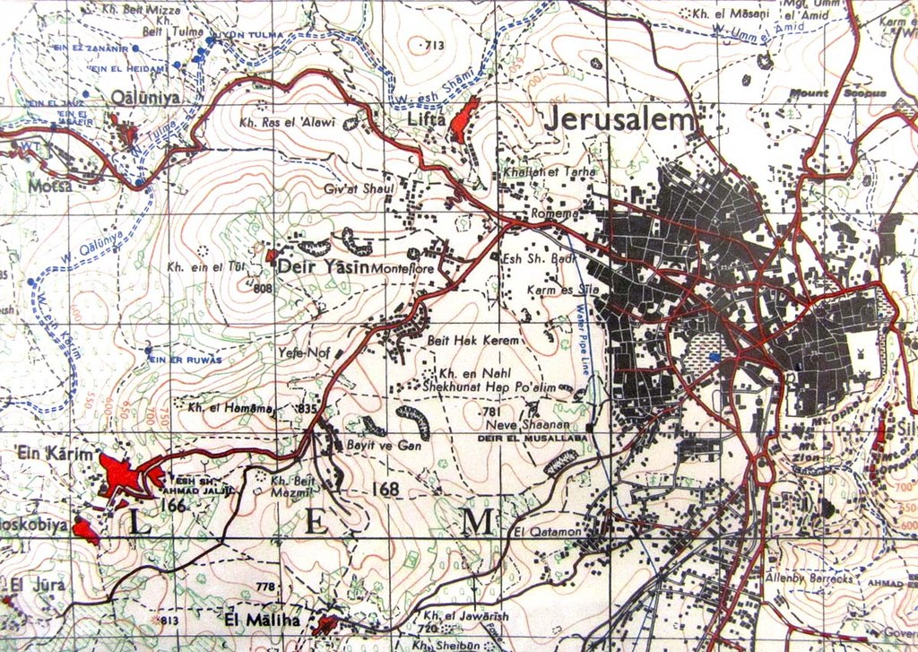
English: Map of Jerusalem and region to its west, 1943. The grid size is 1km. |
||||
| Date | |||||
| Source | British army survey map of 1943, 1:50000 | ||||
| Author | Government of Great Britain | ||||
| Permission (Reusing this file) |
|
||||
File history
Click on a date/time to view the file as it appeared at that time.
| Date/Time | Thumbnail | Dimensions | User | Comment | |
|---|---|---|---|---|---|
| current | 12:38, 8 April 2010 | | 1,200 × 852 (290 KB) | Zero0000 | {{Information |Description={{en|1=Map of Jerusalem and region to its west, 1943. The grid size is 1km.}} |Source=British army survey map of 1943, 1:50000 |Author=Government of Great Britain |Date=1943 |Permission={{PD-old}} |other_versions= }} |
File usage
The following 2 pages use this file:
Global file usage
The following other wikis use this file:
- Usage on es.wikipedia.org
- Usage on he.wikipedia.org
- Usage on nl.wikipedia.org
- Usage on pl.wikipedia.org