Original file (1,000 × 803 pixels, file size: 195 KB, MIME type: image/jpeg)
| This is a file from the Wikimedia Commons. Information from its description page there is shown below. Commons is a freely licensed media file repository. You can help. |
Summary
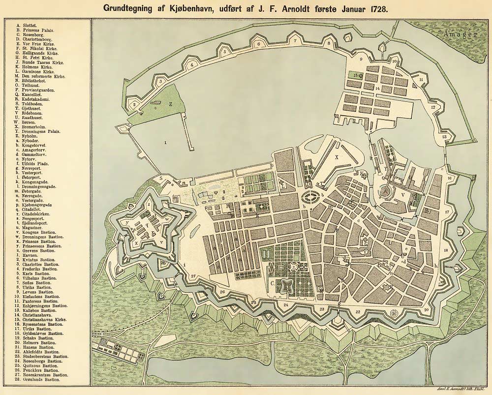
Map of Copenhagen made by J.F. Arnoldt January 1728. This depiction is from Oluf Nielsen: Kjøbenhavn paa Holbergs Tid, Copenhagen 1884. A modified version (without the text in Danish) can be found at Image:København1728modified.jpeg. The scan is used with permission from http://www.eremit.dk archive copy at the Wayback Machine.
The image has been uploaded in a new version that is processed to improve the image quality; the content is unchanged.
North is on the left of the map, South on the right though not exactly 90 degrees.
Licensing
|
This work is in the public domain in its country of origin and other countries and areas where the copyright term is the author's life plus 70 years or fewer. | |
| This file has been identified as being free of known restrictions under copyright law, including all related and neighboring rights. | |
File history
Click on a date/time to view the file as it appeared at that time.
| Date/Time | Thumbnail | Dimensions | User | Comment | |
|---|---|---|---|---|---|
| current | 09:59, 15 January 2006 | | 1,000 × 803 (195 KB) | Heje | The old map of Copenhagen in an improved version |
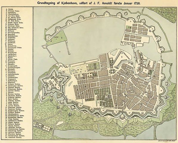
| 02:26, 30 September 2005 |  | 1,000 × 803 (259 KB) | Heelgrasper | Map of Copenhagen made by J.F. Arnoldt January 1728. This depiction is from Oluf Nielsen: ''Kjøbenhavn paa Holbergs Tid'', Copenhagen 1884. The scan is used with permission from http://www.eremit.dk. Category:Copenhagen Category:Maps |
File usage
Global file usage
The following other wikis use this file:
- Usage on ar.wikipedia.org
- Usage on da.wikipedia.org
- Lokalplan
- Voldanlæg
- Fingerplanen
- Stadsgraven
- Københavns volde
- Regional planlægning
- Slumkvarter
- Byplanlægning i Danmark
- Byudviklingsplan
- Fredningsplan
- Zoneplanen
- Fredningskendelse
- Køge Bugt-planen
- Dispositionsplan
- Partiel byplanvedtægt
- Bygningsreglement
- Byggeområdeplan
- Kommuneplan
- Magelægsplan
- Retningsplan
- Reguleringsplan
- Vejadgangsplan
- Udstykningsplan
- Landsplanlægning i Danmark
- Landsplandirektiv
- Byfornyelse
- Saneringsplaner i Danmark
- Byplanlov
- Diskussion:København/arkiv
- Wikipedia:Ugens artikel/2011
- Skabelon:Byplanlægning i Danmark
- Wikipedia:Ugens artikel/Uge 4, 2011
- Norges hovedstad
- Generalplanskitsen
- Usage on da.wikibooks.org
- Usage on es.wikipedia.org
- Usage on fa.wikipedia.org
- Usage on fy.wikipedia.org
- Usage on nn.wikipedia.org
- Usage on no.wikipedia.org
- Usage on pl.wikipedia.org
- Usage on sv.wikipedia.org