Size of this preview: 800 × 556 pixels. Other resolutions: 320 × 222 pixels | 640 × 445 pixels | 1,024 × 712 pixels | 1,280 × 890 pixels | 1,479 × 1,028 pixels.
Original file (1,479 × 1,028 pixels, file size: 855 KB, MIME type: image/jpeg)
| This is a file from the Wikimedia Commons. Information from its description page there is shown below. Commons is a freely licensed media file repository. You can help. |
Licensing
|
This work is in the public domain in its country of origin and other countries and areas where the copyright term is the author's life plus 70 years or fewer. | |
| This file has been identified as being free of known restrictions under copyright law, including all related and neighboring rights. | |
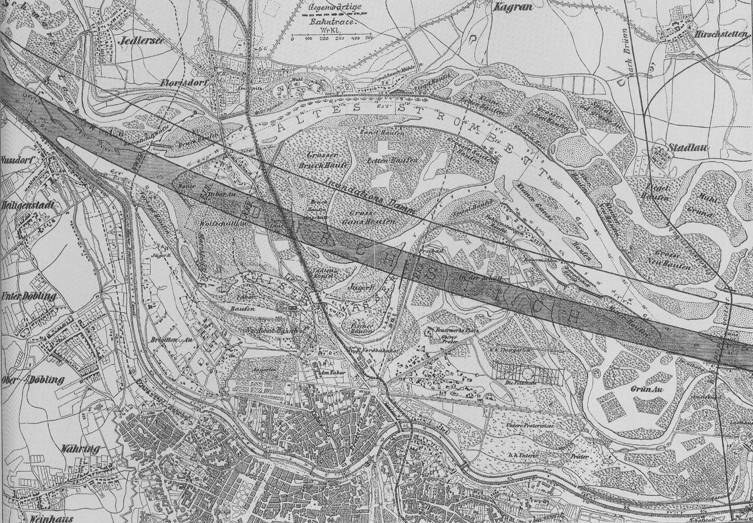
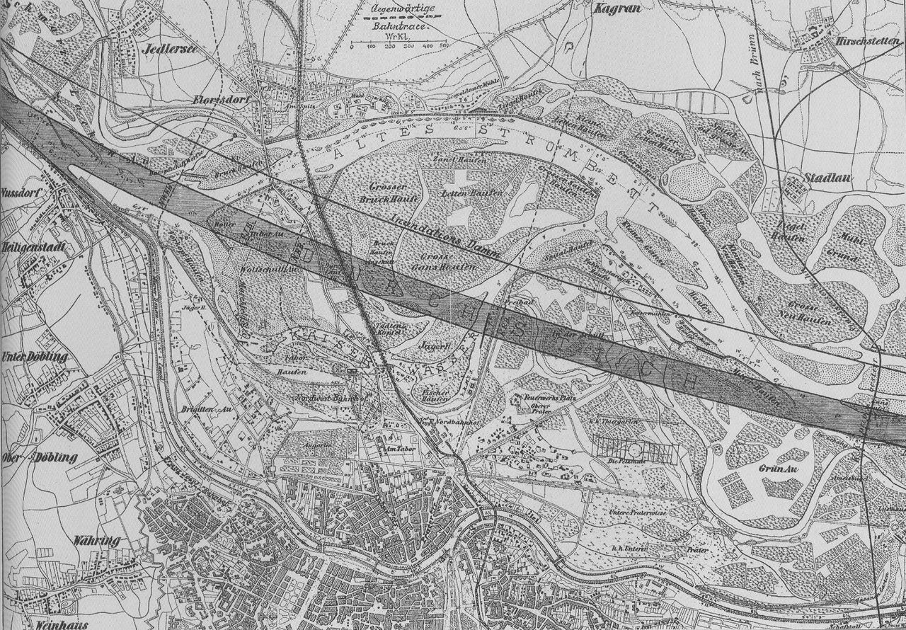
| Description | Plan of the danube-regulation |
| Date | between circa 1870 and circa 1875 |
| Source | Scanned by Geiserich77 from: Hinkel, Raimund: Wien XXI. Floridsdorf. Das Heimatbuch. Wien 1994. |
| Author | Unknown author |
| Permission (Reusing this file) |
Public Domain because of age |
File history
Click on a date/time to view the file as it appeared at that time.
| Date/Time | Thumbnail | Dimensions | User | Comment | |
|---|---|---|---|---|---|
| current | 10:27, 18 October 2005 | | 1,479 × 1,028 (855 KB) | Geiserich77 | == Licensing == {{PD-old}} {{Information| |Description = Plan of the danube-regulation |Source = Scanned by Geiserich77 from: Hinkel, Raimund: ''Wien XXI. Floridsdorf. Das Heimatbuch.'' Wien 1994. |Date = about 1870-1875 |Author = un |
File usage
The following pages on the English Wikipedia use this file (pages on other projects are not listed):
Global file usage
The following other wikis use this file:
- Usage on da.wikipedia.org
- Usage on de.wikipedia.org
- Usage on id.wikipedia.org
- Usage on uk.wikipedia.org