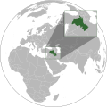
Size of this PNG preview of this SVG file: 512 × 512 pixels. Other resolutions: 240 × 240 pixels | 480 × 480 pixels | 768 × 768 pixels | 1,024 × 1,024 pixels | 2,048 × 2,048 pixels.
Original file (SVG file, nominally 512 × 512 pixels, file size: 852 KB)
File history
Click on a date/time to view the file as it appeared at that time.
| Date/Time | Thumbnail | Dimensions | User | Comment | |
|---|---|---|---|---|---|
| current | 03:25, 11 November 2023 |  | 512 × 512 (852 KB) | Treetoes023 | Making border overlap easier to see. |
| 17:24, 28 September 2023 |  | 512 × 512 (852 KB) | Golden | restoring previous edit but with the shading | |
| 02:15, 28 September 2023 |  | 512 × 512 (794 KB) | Treetoes023 | Reverted to version as of 19:21, 13 June 2023 (UTC): Restoring shading. | |
| 20:09, 1 September 2023 |  | 512 × 512 (885 KB) | Golden | rmv de facto countries with zero recognition (Somaliland, NKR) | |
| 19:21, 13 June 2023 |  | 512 × 512 (794 KB) | Isochrone | oops | |
| 19:17, 13 June 2023 |  | 512 × 512 (793 KB) | Isochrone | change per request | |
| 16:45, 5 June 2023 |  | 512 × 512 (836 KB) | Isochrone | Uploaded a work by {{u|Isochrone}} from {{own using}} * 1992 CIA map with UploadWizard |
File usage
The following 3 pages use this file:
Global file usage
The following other wikis use this file:
- Usage on ar.wikipedia.org
- Usage on ckb.wikipedia.org
- Usage on got.wikipedia.org
- Usage on incubator.wikimedia.org
- Usage on ka.wikipedia.org
- Usage on lt.wikipedia.org
- Usage on mr.wikipedia.org
- Usage on ne.wikipedia.org
- Usage on pl.wikipedia.org
- Usage on qu.wikipedia.org
- Usage on simple.wikipedia.org
- Usage on te.wikipedia.org
- Usage on zh.wikipedia.org
