Size of this preview: 583 × 600 pixels. Other resolutions: 233 × 240 pixels | 466 × 480 pixels | 746 × 768 pixels | 995 × 1,024 pixels | 1,990 × 2,048 pixels | 4,137 × 4,257 pixels.
Original file (4,137 × 4,257 pixels, file size: 1.22 MB, MIME type: image/jpeg)
File history
Click on a date/time to view the file as it appeared at that time.
| Date/Time | Thumbnail | Dimensions | User | Comment | |
|---|---|---|---|---|---|
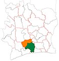
| current | 05:23, 20 December 2015 |  | 4,137 × 4,257 (1.22 MB) | Good Olfactory | Better format/quality. Map style matches that of departments of same country. More appropriate colour scheme for country (colours from flag). |
| 01:43, 5 December 2015 |  | 1,444 × 1,513 (215 KB) | Good Olfactory | User created page with UploadWizard |
File usage
The following 23 pages use this file:
- Chiépo
- Dairo-Didizo
- Didoko
- Divo, Ivory Coast
- Divo Department
- Djidji
- Gagoré
- Goudouko
- Guitry, Ivory Coast
- Guitry Department
- Hiré
- Lakota, Ivory Coast
- Lakota Department
- Lauzoua
- Lôh-Djiboua
- Niambézaaria
- Nébo
- Ogoudou
- Yocoboué
- Zikisso
- Zégo
- User:GerardM/Regions of Ivory Coast
- Template:Lôh-Djiboua Region subdivisions
Global file usage
The following other wikis use this file:
- Usage on ca.wikipedia.org
- Usage on de.wikipedia.org
- Usage on es.wikipedia.org
- Usage on fi.wikipedia.org
- Usage on fr.wikipedia.org
- Usage on ha.wikipedia.org
- Usage on ig.wikipedia.org
- Usage on it.wikipedia.org
- Usage on ja.wikipedia.org
- Usage on sw.wikipedia.org
- Usage on ts.wikipedia.org
- Usage on ur.wikipedia.org
- Usage on www.wikidata.org
- Usage on yo.wikipedia.org
- Usage on zu.wikipedia.org