File:Lillesand-Flaksvand map.jpg

Lillesand-Flaksvand_map.jpg(699 × 591 pixels, file size: 748 KB, MIME type: image/jpeg)

Summary

Description
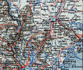
Norsk bokmål: Kart over Lillesand-flaksvandbanen.
Date
Source Kart over Lister og Mandals Amt sammensat efter Generalkart over det sydlige Norge ved Norges geografiske Opmaaling.
Author Mahlum
Permission
(Reusing this file)
Public domain

This work is in the public domain in its country of origin and other countries and areas where the copyright term is the author's life plus 70 years or fewer.


You must also include a United States public domain tag to indicate why this work is in the public domain in the United States.

Licensing

Public domain I, the copyright holder of this work, release this work into the public domain. This applies worldwide.
In some countries this may not be legally possible; if so:
I grant anyone the right to use this work for any purpose, without any conditions, unless such conditions are required by law.

Captions

Add a one-line explanation of what this file represents

Items portrayed in this file

depicts

File history

Click on a date/time to view the file as it appeared at that time.

Date/TimeThumbnailDimensionsUserComment
current13:36, 20 April 2008Thumbnail for version as of 13:36, 20 April 2008699 × 591 (748 KB)Mahlum== Beskrivelse == {{Information |Description={{no|Kart over Lillesand-flaksvandbanen.}} |Source=''Kart over Lister og Mandals Amt sammensat efter Generalkart over det sydlige Norge ved Norges geografiske Opmaaling.'' |Date=1903 |Author= [[User:Mahlum|Mahl
The following pages on the English Wikipedia use this file (pages on other projects are not listed):

Global file usage

The following other wikis use this file:

Metadata