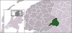
LocatieOoststellingwerf.png (280 × 130 pixels, file size: 8 KB, MIME type: image/png)
File history
Click on a date/time to view the file as it appeared at that time.
| Date/Time | Thumbnail | Dimensions | User | Comment | |
|---|---|---|---|---|---|
| current | 13:54, 9 January 2006 |  | 280 × 130 (8 KB) | Michiel1972 | *'''Description:''' {{dutch locator map}} gemeente Ooststellingwerf. category:Maps of Friesland |
File usage
No pages on the English Wikipedia use this file (pages on other projects are not listed).
Global file usage
The following other wikis use this file:
- Usage on da.wikipedia.org
- Usage on eo.wikipedia.org
- Usage on es.wikipedia.org
- Usage on fi.wikipedia.org
- Usage on fr.wikipedia.org
- Usage on id.wikipedia.org
- Usage on jv.wikipedia.org
- Usage on li.wikipedia.org
- Usage on nds-nl.wikipedia.org
- Usage on ro.wikipedia.org
- Usage on stq.wikipedia.org
- Usage on sv.wikipedia.org
- Usage on vi.wikipedia.org
- Usage on zh-min-nan.wikipedia.org
