
Size of this preview: 557 × 599 pixels. Other resolutions: 223 × 240 pixels | 446 × 480 pixels | 883 × 950 pixels.
Original file (883 × 950 pixels, file size: 151 KB, MIME type: image/png)
| This is a file from the Wikimedia Commons. Information from its description page there is shown below. Commons is a freely licensed media file repository. You can help. |
| Description |
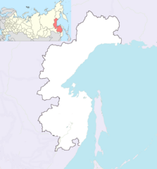
English: Map of Khabarovsk Krai
Geographic limits of the map:
|
| Date | |
| Source | Own work based on OpenStreetMap, inset map is File:Map of Russia - Khabarovsk Krai (2008-03).svg at 400 pixel wide resolution. |
| Author | Dr. Blofeld, inset map by Виктор В and Marmelad, composite map pasted together by Ruhrfisch (talk) |
| Permission (Reusing this file) |
Note OpenStreetMap and Dr. Bolfeld's work original permission is This file is licensed under the Creative Commons Attribution-Share Alike 2.0 Generic license.
This file is licensed under the Creative Commons Attribution-Share Alike 2.5 Generic license.
|
.svg)
File history
Click on a date/time to view the file as it appeared at that time.
| Date/Time | Thumbnail | Dimensions | User | Comment | |
|---|---|---|---|---|---|
| current | 15:51, 8 March 2011 | | 883 × 950 (151 KB) | Ruhrfisch | Added inset map to show location within Russia. Inset map is File:Map of Russia - Khabarovsk Krai (2008-03).svg - will add full details next. |
| 13:02, 8 March 2011 |  | 883 × 950 (97 KB) | Blofeld Dr. | ||
| 12:54, 8 March 2011 |  | 883 × 950 (112 KB) | Blofeld Dr. | {{Information |Description ={{en|1=t}} |Source =t |Author =t |Date =t |Permission = |other_versions = }} |
.svg)
File usage
The following pages on the English Wikipedia use this file (pages on other projects are not listed):