Size of this PNG preview of this SVG file: 566 × 599 pixels. Other resolutions: 227 × 240 pixels | 453 × 480 pixels | 725 × 768 pixels | 967 × 1,024 pixels | 1,934 × 2,048 pixels | 1,449 × 1,534 pixels.
Original file (SVG file, nominally 1,449 × 1,534 pixels, file size: 10.41 MB)
File history
Click on a date/time to view the file as it appeared at that time.
| Date/Time | Thumbnail | Dimensions | User | Comment | |
|---|---|---|---|---|---|
| current | 02:31, 30 December 2023 |  | 1,449 × 1,534 (10.41 MB) | Rvd4life | Telangana state boundary |
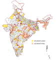
| 02:14, 30 December 2023 |  | 1,449 × 1,534 (10.4 MB) | Rvd4life | {{Information |Description={{de|1=Die 543 Wahlkreise zur Lok Sabha in Indien.}}{{en|1=The 543 Lok Sabha constituencies.}} |Source={{Derived from|Wahlkreise in Indien.svg|display=40}} - new state boundaries added |Date=2014-12-31 |Author=Furfur |Permission={{cc-by-sa-3.0}} |Other fields={{Igen|A|+}} }} Category:Lok Sabha constituency maps of Indian States and Union Territories |
File usage
The following 4 pages use this file:
Global file usage
The following other wikis use this file:
- Usage on ar.wikipedia.org
- Usage on as.wikipedia.org
- Usage on bn.wikipedia.org
- Usage on fa.wikipedia.org
- Usage on kn.wikipedia.org
- Usage on mr.wikipedia.org
- Usage on pa.wikipedia.org
- Usage on sat.wikipedia.org
- Usage on te.wikipedia.org
- Usage on th.wikipedia.org