
Size of this preview: 800 × 519 pixels. Other resolutions: 320 × 208 pixels | 640 × 415 pixels | 1,024 × 664 pixels | 1,280 × 831 pixels | 1,854 × 1,203 pixels.
Original file (1,854 × 1,203 pixels, file size: 1.36 MB, MIME type: image/jpeg)
| This is a file from the Wikimedia Commons. Information from its description page there is shown below. Commons is a freely licensed media file repository. You can help. |
| Description |
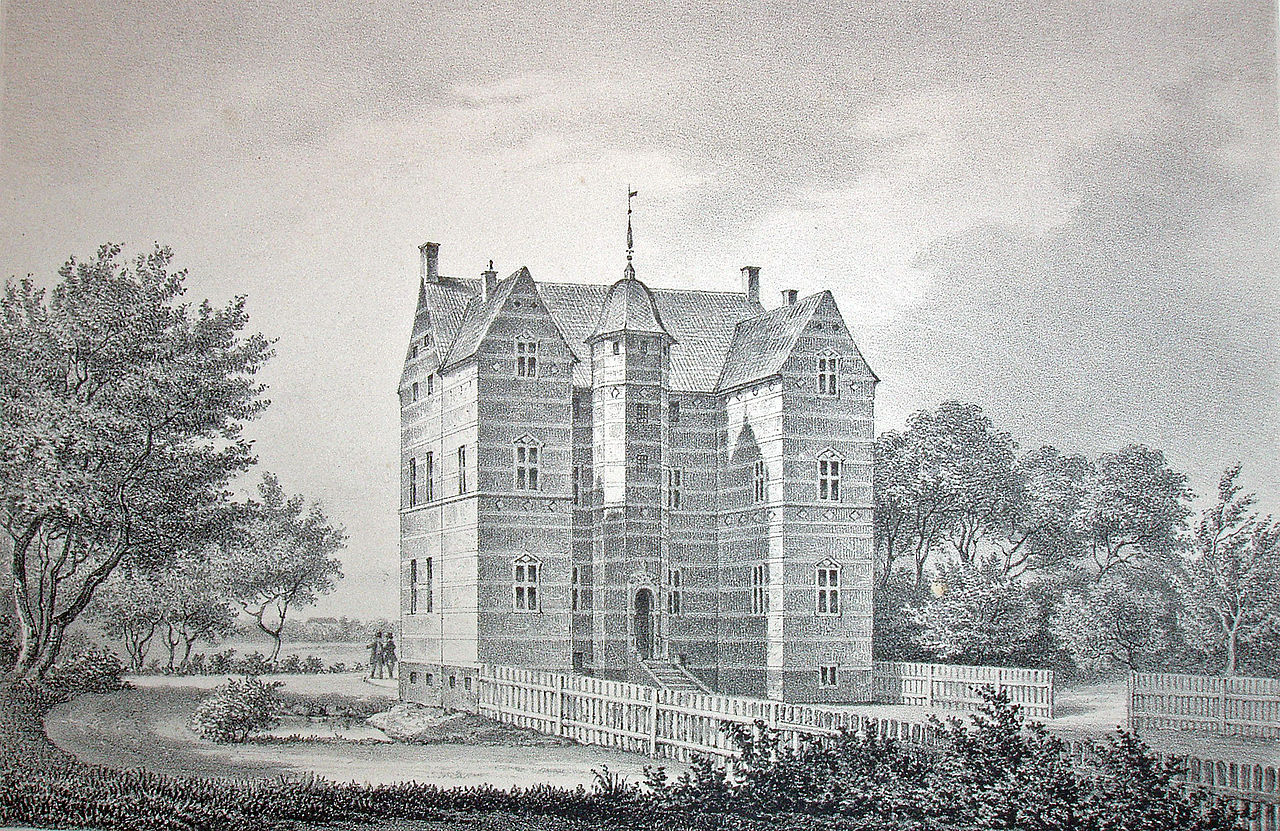
Dansk: Lystrup er en herregård, der ligger 2 km vest for Faxe i Kongsted Sogn, Faxe Kommune.
Slottet er opført 1579 af rigskansler Eiler Grubbe i nederlandsk renæssancestil. På herregården findes bl.a. nogle billedskærerarbejder af billedskæreren Abel Schrøder fra Næstved. |
||||
| Date | |||||
| Source | Prospecter af danske Herregaarde | ||||
| Author | F. Richardt | ||||
| Permission (Reusing this file) |
|
||||
| Other versions | da:Lystrup (Kongsted Sogn) | ||||
| Camera location | | View this and other nearby images on: OpenStreetMap |
|---|
| Object location | | View this and other nearby images on: OpenStreetMap |
|---|
File history
Click on a date/time to view the file as it appeared at that time.
| Date/Time | Thumbnail | Dimensions | User | Comment | |
|---|---|---|---|---|---|
| current | 12:06, 6 February 2008 | | 1,854 × 1,203 (1.36 MB) | Nico-dk | {{Information |Description=da:''' Lystrup''' er en herregård, der ligger 2 km vest for Faxe i Kongsted Sogn, Faxe Kommune. Slottet er opført 1579 af rigskansler Eiler Grubbe i nederlandsk renæssancestil. På herregården findes bl.a. nogle billedskære |
File usage
The following pages on the English Wikipedia use this file (pages on other projects are not listed):
Global file usage
The following other wikis use this file:
- Usage on da.wikipedia.org
- Usage on sv.wikipedia.org
- Usage on www.wikidata.org