Size of this preview: 600 × 600 pixels. Other resolutions: 240 × 240 pixels | 480 × 480 pixels | 768 × 768 pixels | 1,024 × 1,024 pixels | 2,400 × 2,400 pixels.
Original file (2,400 × 2,400 pixels, file size: 3.04 MB, MIME type: image/jpeg)
File history
Click on a date/time to view the file as it appeared at that time.
| Date/Time | Thumbnail | Dimensions | User | Comment | |
|---|---|---|---|---|---|
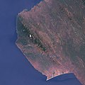
| current | 17:14, 2 May 2006 |  | 2,400 × 2,400 (3.04 MB) | Holly Cheng | {{Information | Description=Satellite image of w:Mahale Mountains National Park along w:Lake Tanganyika, Tanzania. The park borders are outlined in yellow. | Source=http://earthobservatory.nasa.gov/Newsroom/NewImages/images.php3?img_id=17092 | Dat |
File usage
The following page uses this file:
Global file usage
The following other wikis use this file:
- Usage on ar.wikipedia.org
- Usage on bg.wikipedia.org
- Usage on fi.wikipedia.org
- Usage on fr.wikipedia.org
- Usage on it.wikipedia.org
- Usage on ru.wikipedia.org
- Usage on uk.wikipedia.org
- Usage on zh.wikipedia.org

