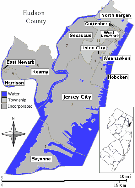
Map_Hudson_County_NJ_municipalities.gif (430 × 599 pixels, file size: 25 KB, MIME type: image/gif)
File history
Click on a date/time to view the file as it appeared at that time.
| Date/Time | Thumbnail | Dimensions | User | Comment | |
|---|---|---|---|---|---|
| current | 23:37, 21 August 2007 |  | 430 × 599 (25 KB) | Wikid77 | added forgotten name "West New York" on area #5 |
| 23:19, 21 August 2007 |  | 430 × 599 (24 KB) | Wikid77 | redrew entire map with detailed water-boundaries (actually more narrow 430px), with darker town names | |
| 17:21, 21 August 2007 |  | 540 × 580 (21 KB) | Wikid77 | {{Information | Description= Closeup view of map of Hudson County, New Jersey (in style of map work by Jim Irwin, December 2005), with distance scale in miles/kilometers, Interstate-icons enlarged 50%, town names clarifie |
File usage
No pages on the English Wikipedia use this file (pages on other projects are not listed).


